Concepcion night lights from space
Night Light of Concepcion (Western Visayas) from space (Philippines) Src. Average luminocity for 10x10km area is 6.2521% and for 50x50km: 5.9014%.
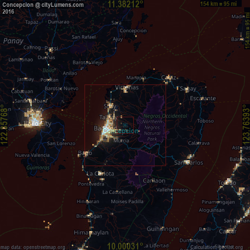
Analysis of Concepcion night lights 2016
Square area 10x10 km:
 0%
0%90-99
0%80-89
0.83%70-79
0%60-69
0.83%50-59
0.62%40-49
0.21%30-39
3.31%20-29
1.03%10-19
12.6%0-9
80.58%Square area 50x50 km:
0.41%90-99
0.54%80-89
0.96%70-79
1.02%60-69
1.02%50-59
0.62%40-49
0.92%30-39
1.12%20-29
1.73%10-19
4.25%0-9
87.42%Clear (daylight) street map image can be seen on geolist.org.
Map coordinates:
11° 22' 55.6" North, 122° 21' 27.6" East
10° 41' 31.2" North, 123° 3' 38.9" East
10° 0' 1.1" North, 123° 45' 50.1" East
Some cities around Concepcion sort by population:
• Bacolod City
12.4 km =7.7 mi,  256°
256°
• Mansilingan
11.2 km =7 mi,  232°
232°
• Binonga
12.4 km =7.7 mi,  315°
315°
• Talisay
11.5 km =7.1 mi,  296°
296°
• Sumag
18.5 km =11.5 mi,  236°
236°
• Murcia
9.9 km =6.2 mi,  192°
192°
• Eustaquio Lopez
14.3 km =8.9 mi,  351°
351°
• Dos Hermanas
6.1 km =3.8 mi,  335°
335°
1717025 (p: 8,903)
Sources (retrieved 2019-11-25):
» Earth at Night: Flat Maps 2012, 2016