Murcia night lights from space
Night Light of Murcia (Western Visayas) from space (Philippines) Src. Average luminocity for 10x10km area is 6.1426% and for 50x50km: 5.9978%.
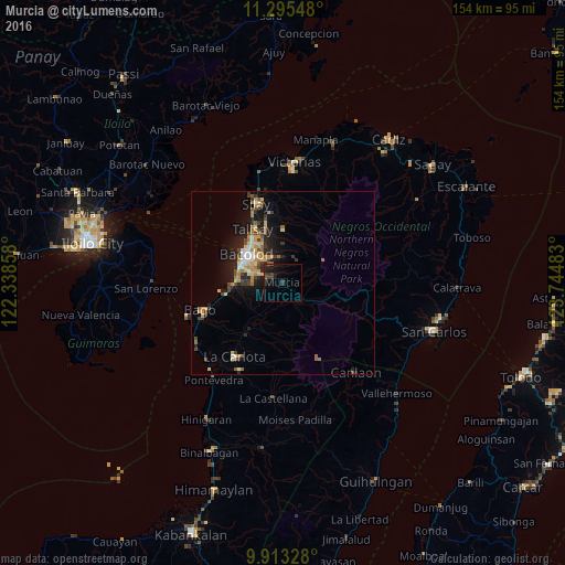
Analysis of Murcia night lights 2016
Square area 10x10 km:
 0%
0%90-99
0%80-89
0%70-79
0%60-69
0%50-59
1.45%40-49
2.69%30-39
2.27%20-29
4.13%10-19
8.06%0-9
81.4%Square area 50x50 km:
0.4%90-99
0.57%80-89
0.96%70-79
1.03%60-69
1.07%50-59
0.64%40-49
0.95%30-39
1.15%20-29
1.73%10-19
4.28%0-9
87.21%Clear (daylight) street map image can be seen on geolist.org.
Map coordinates:
11° 17' 43.7" North, 122° 20' 18.9" East
10° 36' 18.6" North, 123° 2' 30.1" East
9° 54' 47.8" North, 123° 44' 41.4" East
Some cities around Murcia sort by population:
• Bacolod City
12.1 km =7.5 mi,  304°
304°
• Mansilingan
7.4 km =4.6 mi,  292°
292°
• Maao
14 km =8.7 mi,  203°
203°
• Sumag
13.4 km =8.3 mi,  268°
268°
• Dos Hermanas
15.2 km =9.4 mi,  358°
358°
• Concepcion
9.9 km =6.2 mi,  12°
12°
• Minuyan
12.3 km =7.6 mi,  145°
145°
• Dulao
13.3 km =8.3 mi,  238°
238°
1699060 (p: 17,448)
Sources (retrieved 2019-11-25):
» Earth at Night: Flat Maps 2012, 2016