Binonga night lights from space
Night Light of Binonga (Western Visayas) from space (Philippines) Src. Average luminocity for 10x10km area is 23.3802% and for 50x50km: 5.7713%.
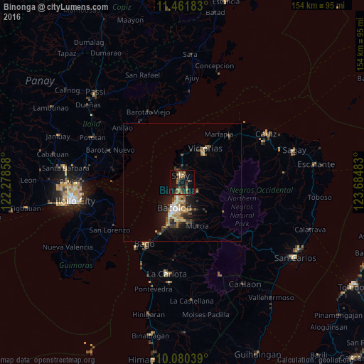
Analysis of Binonga night lights 2016
Square area 10x10 km:
 0.41%
0.41%90-99
0.41%80-89
3.1%70-79
3.72%60-69
6.4%50-59
4.55%40-49
3.31%30-39
6.2%20-29
3.1%10-19
29.55%0-9
39.26%Square area 50x50 km:
0.41%90-99
0.54%80-89
0.94%70-79
0.91%60-69
0.98%50-59
0.67%40-49
0.9%30-39
1.03%20-29
1.73%10-19
4.24%0-9
87.64%Clear (daylight) street map image can be seen on geolist.org.
Map coordinates:
11° 27' 42.6" North, 122° 16' 42.9" East
10° 46' 18.8" North, 122° 58' 54.1" East
10° 4' 49.4" North, 123° 41' 5.4" East
Some cities around Binonga sort by population:
• Bacolod City
12.2 km =7.6 mi,  196°
196°
• Mansilingan
15.7 km =9.8 mi,  181°
181°
• Talisay
4.2 km =2.6 mi, 203°
• Saravia
11.8 km =7.3 mi,  352°
352°
• Eustaquio Lopez
8.4 km =5.2 mi,  50°
50°
• Dos Hermanas
7 km =4.3 mi,  118°
118°
• Concepcion
12.4 km =7.7 mi,  135°
135°
• Alicante
14.5 km =9 mi,  16°
16°
1724933 (p: 83,980)
Sources (retrieved 2019-11-25):
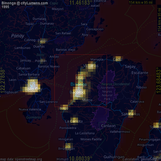
» NASA, Earths city lights 1995
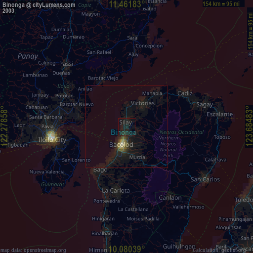
» NASA city lights 2003
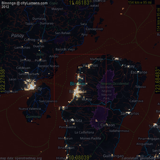
» Earth at Night: Flat Maps 2012, 2016