Bulolo night lights from space
Night Light of Bulolo (Morobe) from space (Papua New Guinea) Src. Average luminocity for 10x10km area is 1.987% and for 50x50km: 0.2042%.
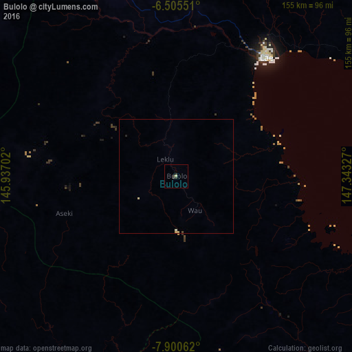
Analysis of Bulolo night lights 2016
Square area 10x10 km:
 0%
0%90-99
0%80-89
0.87%70-79
0%60-69
0%50-59
0%40-49
0%30-39
2.6%20-29
0%10-19
0.87%0-9
95.67%Square area 50x50 km:
0%90-99
0.03%80-89
0.1%70-79
0%60-69
0%50-59
0%40-49
0.02%30-39
0.1%20-29
0.03%10-19
0.03%0-9
99.67%Clear (daylight) street map image can be seen on geolist.org.
Map coordinates:
6° 30' 19.8" South, 145° 56' 13.3" East
7° 12' 13" South, 146° 38' 24.5" East
7° 54' 2.2" South, 147° 20' 35.8" East
Some cities around Bulolo sort by population:
• Lae
66.3 km =41.2 mi,  36°
36°
• Madang
239.7 km =148.9 mi,  336°
336°
• Goroka
186.1 km =115.6 mi,  311°
311°
• Wau
17.1 km =10.6 mi,  150°
150°
• Kundiawa
226.7 km =140.9 mi, 305°
• Kainantu
132.9 km =82.6 mi,  319°
319°
• Kokoda
221.9 km =137.9 mi, 147°
• Kerema
127.3 km =79.1 mi,  228°
228°
2098869 (p: 16,042)
Sources (retrieved 2019-11-25):
» Earth at Night: Flat Maps 2012, 2016