Túcume night lights from space
Night Light of Túcume (Lambayeque) from space (Peru) Src. Average luminocity for 10x10km area is 8.7879% and for 50x50km: 3.9168%.
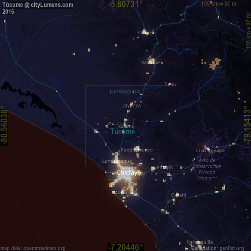
Analysis of Túcume night lights 2016
Square area 10x10 km:
 0%
0%90-99
1.95%80-89
2.81%70-79
0%60-69
0.87%50-59
0.87%40-49
1.08%30-39
3.25%20-29
1.52%10-19
1.95%0-9
85.71%Square area 50x50 km:
0.21%90-99
0.48%80-89
0.51%70-79
0.28%60-69
0.46%50-59
0.51%40-49
1.02%30-39
0.93%20-29
1.14%10-19
2.73%0-9
91.73%Clear (daylight) street map image can be seen on geolist.org.
Map coordinates:
5° 48' 26.3" South, 80° 33' 37.4" West
6° 30' 22.9" South, 79° 51' 26.1" West
7° 12' 16.1" South, 79° 9' 14.9" West
Some cities around Túcume sort by population:
• Lambayeque
22.3 km =13.9 mi,  193°
193°
• Picsi
25.4 km =15.8 mi,  157°
157°
• Ferreñafe
16.6 km =10.3 mi,  152°
152°
• Santa Rosa
28.1 km =17.5 mi,  173°
173°
• Mochumí
4.2 km =2.6 mi, 187°
• San José
26 km =16.2 mi, 172°
• Mórrope
17.3 km =10.7 mi,  259°
259°
• Jayanca
13.4 km =8.3 mi,  16°
16°
3691161 (p: 7,043)
Sources (retrieved 2019-11-25):
» Earth at Night: Flat Maps 2012, 2016