Ferreñafe night lights from space
Night Light of Ferreñafe (Lambayeque) from space (Peru) Src. Average luminocity for 10x10km area is 16.9026% and for 50x50km: 11.6866%.
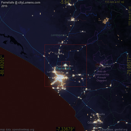
Analysis of Ferreñafe night lights 2016
Square area 10x10 km:
 1.08%
1.08%90-99
3.03%80-89
2.81%70-79
0.22%60-69
2.38%50-59
2.16%40-49
3.03%30-39
2.6%20-29
3.03%10-19
6.28%0-9
73.38%Square area 50x50 km:
1.25%90-99
2.41%80-89
1.58%70-79
1.22%60-69
1.31%50-59
1.45%40-49
2.58%30-39
2.09%20-29
2.87%10-19
5.54%0-9
77.69%Clear (daylight) street map image can be seen on geolist.org.
Map coordinates:
5° 56' 24" South, 80° 29' 31.3" West
6° 38' 20" South, 79° 47' 20" West
7° 20' 12.4" South, 79° 5' 8.8" West
Some cities around Ferreñafe sort by population:
• Chiclayo
15.8 km =9.8 mi,  201°
201°
• Lambayeque
14.7 km =9.1 mi,  241°
241°
• Picsi
9 km =5.6 mi,  166°
166°
• Santa Rosa
13.9 km =8.6 mi, 197°
• Reque
25.4 km =15.8 mi,  187°
187°
• Mochumí
13.3 km =8.3 mi,  322°
322°
• San José
11.8 km =7.3 mi, 201°
• Túcume
16.6 km =10.3 mi,  332°
332°
3697033 (p: 34,357)
Sources (retrieved 2019-11-25):
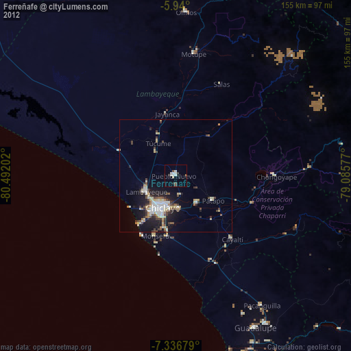
» Earth at Night: Flat Maps 2012, 2016