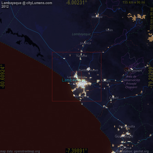
Lambayeque night lights from space
Night Light of Lambayeque from space (Peru) Src. Average luminocity for 10x10km area is 39.8117% and for 50x50km: 12.3986%.
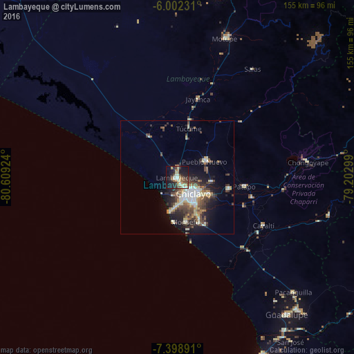
Analysis of Lambayeque night lights 2016
Square area 10x10 km:
100  3.68%
3.68%
90-99 7.36%
80-89 6.49%
70-79 5.63%
60-69 4.98%
50-59 5.41%
40-49 6.71%
30-39 6.93%
20-29 13.42%
10-19 29%
0-9 10.39%
3.68%90-99
7.36%80-89
6.49%70-79
5.63%60-69
4.98%50-59
5.41%40-49
6.71%30-39
6.93%20-29
13.42%10-19
29%0-9
10.39%Square area 50x50 km:
100 1.27%
90-99 2.68%
80-89 1.59%
70-79 1.18%
60-69 1.24%
50-59 1.64%
40-49 2.66%
30-39 2.51%
20-29 3.34%
10-19 6.86%
0-9 75.03%
1.27%90-99
2.68%80-89
1.59%70-79
1.18%60-69
1.24%50-59
1.64%40-49
2.66%30-39
2.51%20-29
3.34%10-19
6.86%0-9
75.03%Clear (daylight) street map image can be seen on geolist.org.
Map coordinates:
6° 0' 8.3" South, 80° 36' 33.3" West
6° 42' 4" South, 79° 54' 22" West
7° 23' 56.1" South, 79° 12' 10.8" West
Some cities around Lambayeque sort by population:
• Chiclayo
10.6 km =6.6 mi,  137°
137°
• Picsi
15.2 km =9.4 mi,  97°
97°
• Ferreñafe
14.7 km =9.1 mi,  61°
61°
• Monsefú
19.7 km =12.2 mi,  167°
167°
• Pimentel
15.4 km =9.6 mi,  191°
191°
• Santa Rosa
10.7 km =6.6 mi,  125°
125°
• Mochumí
18.2 km =11.3 mi,  15°
15°
• San José
9.6 km =6 mi,  115°
115°
3695754 (p: 43,710)
Sources (retrieved 2019-11-25):
» Earth at Night: Flat Maps 2012, 2016