Chiclayo night lights from space
Night Light of Chiclayo (Lambayeque) from space (Peru) Src. Average luminocity for 10x10km area is 83.184% and for 50x50km: 12.5183%.
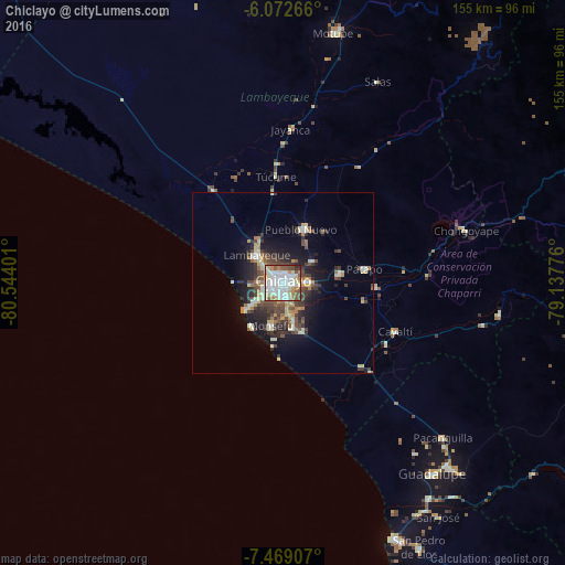
Analysis of Chiclayo night lights 2016
Square area 10x10 km:
 24.46%
90-99
33.98%80-89
9.96%70-79
6.06%60-69
6.28%50-59
9.31%40-49
6.49%30-39
1.95%20-29
1.52%10-19
0%0-9
0%Square area 50x50 km:
1.27%90-99
2.72%80-89
1.69%70-79
1.22%60-69
1.24%50-59
1.52%40-49
2.54%30-39
2.45%20-29
3.37%10-19
6.84%0-9
75.14%Clear (daylight) street map image can be seen on geolist.org.
Map coordinates:
6° 4' 21.6" South, 80° 32' 38.4" West
6° 46' 16.9" South, 79° 50' 27.2" West
7° 28' 8.7" South, 79° 8' 15.9" West
Some cities around Chiclayo sort by population:
• Lambayeque
10.6 km =6.6 mi,  317°
317°
• Picsi
9.9 km =6.2 mi,  52°
52°
• Monsefú
11.9 km =7.4 mi,  195°
195°
• Pimentel
12.6 km =7.8 mi,  234°
234°
• Eten
15.4 km =9.6 mi,  189°
189°
• Santa Rosa
2.1 km =1.3 mi,  44°
44°
• Reque
10.8 km =6.7 mi,  166°
166°
• San José
4 km =2.5 mi,  21°
21°
3698350 (p: 577,375)
Sources (retrieved 2019-11-25):
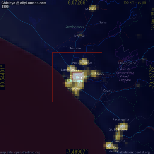
» NASA, Earths city lights 1995
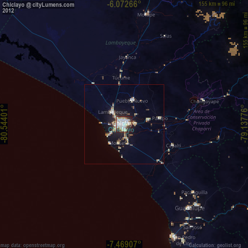
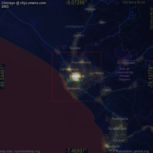
» NASA city lights 2003
» Earth at Night: Flat Maps 2012, 2016