Chongoyape night lights from space
Night Light of Chongoyape (Lambayeque) from space (Peru) Src. Average luminocity for 10x10km area is 6.1126% and for 50x50km: 0.8607%.
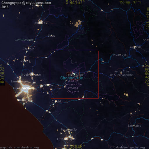
Analysis of Chongoyape night lights 2016
Square area 10x10 km:
 0%
0%90-99
1.52%80-89
1.08%70-79
0.87%60-69
0%50-59
0.22%40-49
0.65%30-39
3.46%20-29
3.03%10-19
0%0-9
89.18%Square area 50x50 km:
0.01%90-99
0.1%80-89
0.2%70-79
0.1%60-69
0.07%50-59
0.21%40-49
0.14%30-39
0.27%20-29
0.22%10-19
0.1%0-9
98.58%Clear (daylight) street map image can be seen on geolist.org.
Map coordinates:
5° 56' 30" South, 80° 5' 32.3" West
6° 38' 26" South, 79° 23' 21" West
7° 20' 18.5" South, 78° 41' 9.8" West
Some cities around Chongoyape sort by population:
• Chiclayo
52 km =32.3 mi,  253°
253°
• Picsi
42.9 km =26.7 mi,  258°
258°
• Saña
37.6 km =23.4 mi,  214°
214°
• Ferreñafe
44.1 km =27.4 mi,  270°
270°
• Santa Rosa
50.1 km =31.1 mi, 254°
• Mochumí
53.3 km =33.1 mi,  281°
281°
• San José
49.6 km =30.8 mi, 257°
• Oyotún
24.7 km =15.3 mi,  156°
156°
3698176 (p: 16,061)
Sources (retrieved 2019-11-25):
» Earth at Night: Flat Maps 2012, 2016