Atuncolla night lights from space
Night Light of Atuncolla (Puno) from space (Peru) Src. Average luminocity for 10x10km area is 0.4459% and for 50x50km: 5.4786%.
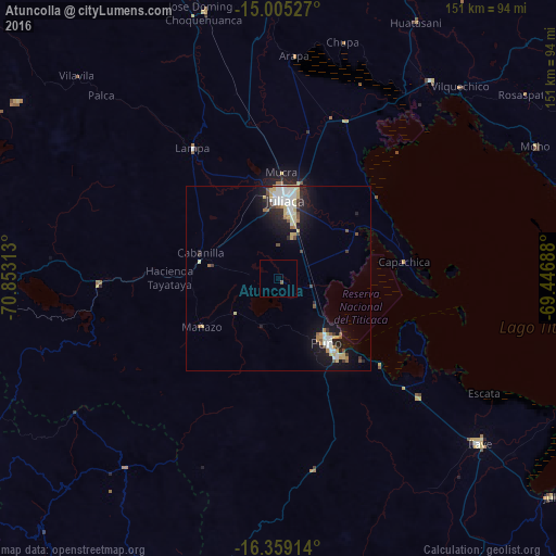
Analysis of Atuncolla night lights 2016
Square area 10x10 km:
 0%
0%90-99
0%80-89
0%70-79
0%60-69
0%50-59
0.65%40-49
0.22%30-39
0%20-29
0%10-19
0%0-9
99.13%Square area 50x50 km:
1%90-99
1.04%80-89
1.01%70-79
0.39%60-69
0.46%50-59
0.48%40-49
0.43%30-39
0.55%20-29
1.32%10-19
4.3%0-9
89.02%Clear (daylight) street map image can be seen on geolist.org.
Map coordinates:
15° 0' 19" South, 70° 51' 11.3" West
15° 40' 60" South, 70° 9' 0" West
16° 21' 32.9" South, 69° 26' 48.8" West
Some cities around Atuncolla sort by population:
• Juliaca
20.5 km =12.7 mi,  5°
5°
• Puno
22.5 km =14 mi,  141°
141°
• Ayaviri
100.3 km =62.3 mi,  332°
332°
• Ilave
68.2 km =42.4 mi,  130°
130°
• Azángaro
86.3 km =53.6 mi,  356°
356°
• Putina
80.2 km =49.8 mi,  73°
73°
• Hacienda Huancane
80.2 km =49.8 mi,  258°
258°
• Juli
95.5 km =59.3 mi, 128°
3947110 (p: 12,654)
Sources (retrieved 2019-11-25):
» Earth at Night: Flat Maps 2012, 2016