Juli night lights from space
Night Light of Juli (Puno) from space (Peru) Src. Average luminocity for 10x10km area is 4.1467% and for 50x50km: 0.7428%.
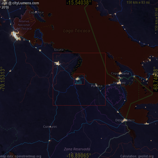
Analysis of Juli night lights 2016
Square area 10x10 km:
 0%
0%90-99
0%80-89
2.48%70-79
0.41%60-69
0.41%50-59
0%40-49
0.83%30-39
1.45%20-29
0.21%10-19
0.83%0-9
93.39%Square area 50x50 km:
0.03%90-99
0.06%80-89
0.29%70-79
0.1%60-69
0.08%50-59
0.08%40-49
0.07%30-39
0.11%20-29
0.09%10-19
0.05%0-9
99.04%Clear (daylight) street map image can be seen on geolist.org.
Map coordinates:
15° 32' 25.4" South, 70° 9' 11.3" West
16° 13' 0" South, 69° 27' 0" West
16° 53' 26.3" South, 68° 44' 48.8" West
Some cities around Juli sort by population:
• Puno
73.8 km =45.9 mi,  304°
304°
• Yunguyo
39.3 km =24.4 mi,  95°
95°
• Ilave
27.5 km =17.1 mi, 302°
• Atuncolla
95.5 km =59.3 mi,  308°
308°
• Achacachi, BO
84 km =52.2 mi,  77°
77°
• Putina
82.3 km =51.1 mi,  1°
1°
• Desaguadero
58.3 km =36.2 mi,  131°
131°
• San Pedro, BO
64 km =39.8 mi,  92°
92°
3937516 (p: 7,309)
Sources (retrieved 2019-11-25):
» Earth at Night: Flat Maps 2012, 2016