Matamata night lights from space
Night Light of Matamata (Waikato) from space (New Zealand) Src. Average luminocity for 10x10km area is 4.0374% and for 50x50km: 0.891%.
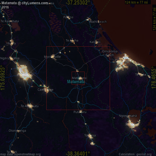
Analysis of Matamata night lights 2016
Square area 10x10 km:
 0%
0%90-99
0%80-89
0.68%70-79
0.68%60-69
0%50-59
1.87%40-49
0.85%30-39
2.38%20-29
0.34%10-19
0.68%0-9
92.52%Square area 50x50 km:
0%90-99
0.01%80-89
0.22%70-79
0.12%60-69
0.08%50-59
0.21%40-49
0.22%30-39
0.36%20-29
0.23%10-19
0.15%0-9
98.4%Clear (daylight) street map image can be seen on geolist.org.
Map coordinates:
37° 15' 10.9" South, 175° 3' 33.3" East
37° 48' 38.2" South, 175° 45' 44.5" East
38° 21' 50.4" South, 176° 27' 55.8" East
Some cities around Matamata sort by population:
• Hamilton
42.2 km =26.2 mi,  274°
274°
• Tauranga
38.1 km =23.7 mi,  68°
68°
• Rotorua
55.9 km =34.7 mi,  130°
130°
• Cambridge
29.3 km =18.2 mi,  255°
255°
• Tokoroa
47.9 km =29.8 mi,  169°
169°
• Thames
77.3 km =48 mi,  345°
345°
• Kawerau
88.3 km =54.9 mi,  111°
111°
• Ngaruawahia
55.7 km =34.6 mi,  286°
286°
6235764 (p: 6,306)
Sources (retrieved 2019-11-25):
» Earth at Night: Flat Maps 2012, 2016