Indre Arna night lights from space
Night Light of Indre Arna (Hordaland) from space (Norway) Src. Average luminocity for 10x10km area is 17.0552% and for 50x50km: 13.66%.
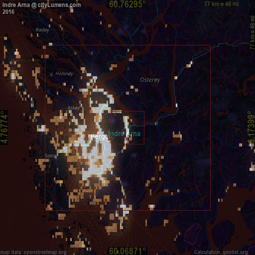
Analysis of Indre Arna night lights 2016
Square area 10x10 km:
 1.95%
1.95%90-99
2.92%80-89
0.97%70-79
2.16%60-69
2.16%50-59
2.38%40-49
0.22%30-39
0.65%20-29
3.14%10-19
40.91%0-9
42.53%Square area 50x50 km:
2.45%90-99
2.51%80-89
0.98%70-79
1.09%60-69
1.5%50-59
3.07%40-49
1.76%30-39
1.94%20-29
4.19%10-19
9.18%0-9
71.32%Clear (daylight) street map image can be seen on geolist.org.
Map coordinates:
60° 45' 46.6" North, 4° 46' 3.9" East
60° 25' 3.6" North, 5° 28' 15.1" East
60° 4' 7.4" North, 6° 10' 26.4" East
Some cities around Indre Arna sort by population:
• Bergen
8.5 km =5.3 mi,  251°
251°
• Haugesund
112.2 km =69.7 mi,  185°
185°
• Ytrebygda
16.3 km =10.1 mi,  219°
219°
• Askøy
15.9 km =9.9 mi,  262°
262°
• Leirvik
70.9 km =44.1 mi,  178°
178°
• Voss
56.7 km =35.2 mi,  65°
65°
• Odda
70.9 km =44.1 mi,  123°
123°
• Hermansverk
113.4 km =70.5 mi,  41°
41°
3162924 (p: 6,117)
Sources (retrieved 2019-11-25):
» Earth at Night: Flat Maps 2012, 2016