Bergen night lights from space
Night Light of Bergen (Hordaland) from space (Norway) Src. Average luminocity for 10x10km area is 53.947% and for 50x50km: 15.0116%.
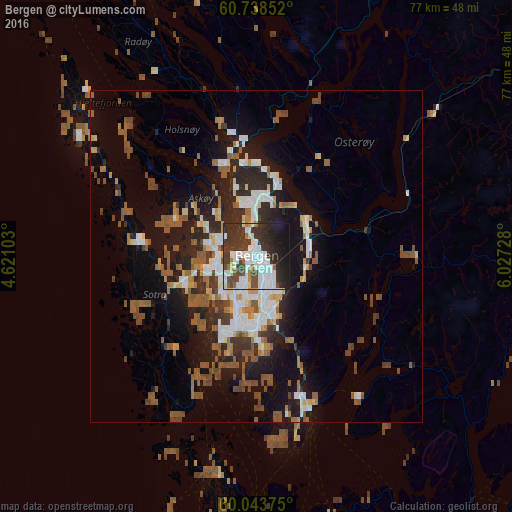
Analysis of Bergen night lights 2016
Square area 10x10 km:
 17.1%
17.1%90-99
15.8%80-89
0.97%70-79
1.73%60-69
2.71%50-59
3.25%40-49
7.79%30-39
17.97%20-29
16.67%10-19
15.69%0-9
0.32%Square area 50x50 km:
2.53%90-99
2.6%80-89
1.01%70-79
1.21%60-69
1.66%50-59
3.59%40-49
2.3%30-39
2.05%20-29
4.31%10-19
9.66%0-9
69.09%Clear (daylight) street map image can be seen on geolist.org.
Map coordinates:
60° 44' 18.7" North, 4° 37' 15.7" East
60° 23' 34.8" North, 5° 19' 26.9" East
60° 2' 37.5" North, 6° 1' 38.2" East
Some cities around Bergen sort by population:
• Haugesund
108.9 km =67.7 mi,  181°
181°
• Ytrebygda
10 km =6.2 mi,  193°
193°
• Askøy
7.8 km =4.8 mi,  275°
275°
• Leirvik
68.9 km =42.8 mi,  171°
171°
• Indre Arna
8.5 km =5.3 mi,  71°
71°
• Voss
65.2 km =40.5 mi, 66°
• Odda
76.4 km =47.5 mi,  118°
118°
• Hermansverk
120.8 km =75.1 mi,  43°
43°
3161732 (p: 213,585)
Sources (retrieved 2019-11-25):
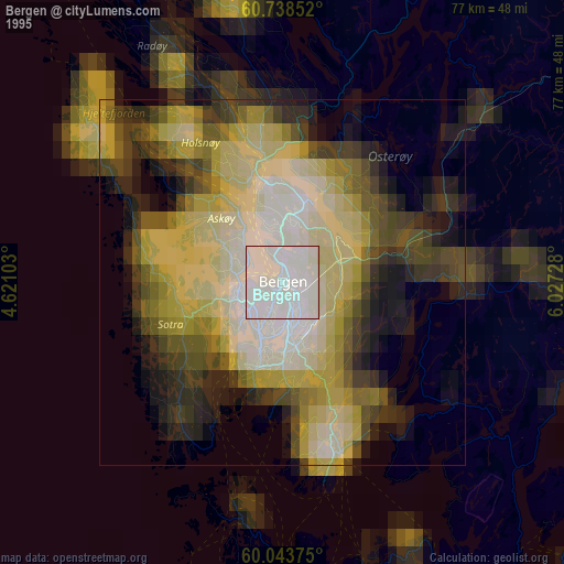
» NASA, Earths city lights 1995
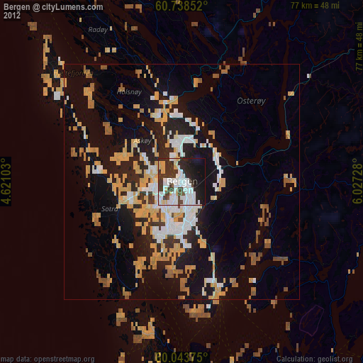
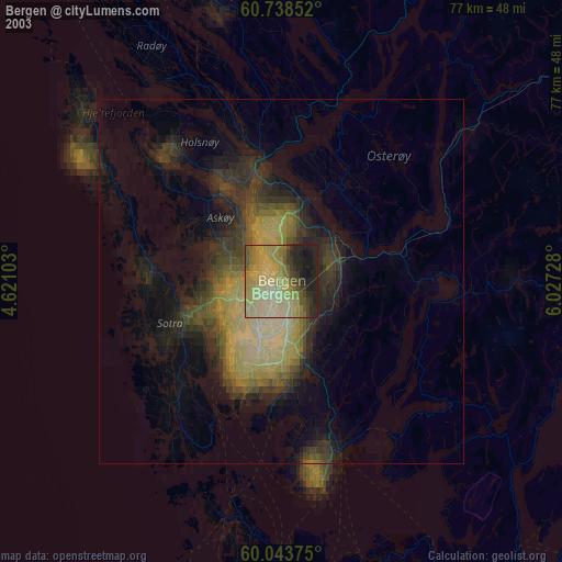
» NASA city lights 2003
» Earth at Night: Flat Maps 2012, 2016