Païta night lights from space
Night Light of Païta (South Province) from space (New Caledonia) Src. Average luminocity for 10x10km area is 16.2956% and for 50x50km: 5.3662%.
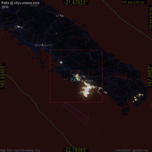
Analysis of Païta night lights 2016
Square area 10x10 km:
 0%
0%90-99
0.99%80-89
3.17%70-79
1.39%60-69
2.38%50-59
3.17%40-49
6.75%30-39
5.56%20-29
1.39%10-19
4.17%0-9
71.03%Square area 50x50 km:
0.74%90-99
1.35%80-89
0.41%70-79
0.38%60-69
0.44%50-59
0.4%40-49
0.92%30-39
0.85%20-29
1.71%10-19
4.18%0-9
88.61%Clear (daylight) street map image can be seen on geolist.org.
Map coordinates:
21° 28' 41.6" South, 165° 39' 14.6" East
22° 7' 51.8" South, 166° 21' 25.8" East
22° 46' 51.1" South, 167° 3' 37.1" East
Some cities around Païta sort by population:
• Nouméa
18.5 km =11.5 mi,  149°
149°
• Mont-Dore
26 km =16.2 mi,  124°
124°
• Dumbéa
10.7 km =6.6 mi,  105°
105°
• Wé
164.4 km =102.2 mi,  34°
34°
• Tadine
170.1 km =105.7 mi,  67°
67°
• Koné
194.8 km =121 mi,  307°
307°
• La Foa
71.9 km =44.7 mi, 310°
• Isangel, VU
418.6 km =260.1 mi,  46°
46°
2138981 (p: 12,617)
Sources (retrieved 2019-11-25):
» Earth at Night: Flat Maps 2012, 2016