Dumbéa night lights from space
Night Light of Dumbéa (South Province) from space (New Caledonia) Src. Average luminocity for 10x10km area is 14.4048% and for 50x50km: 5.4382%.
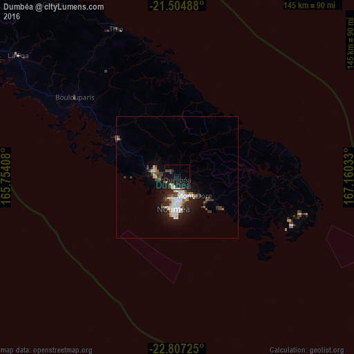
Analysis of Dumbéa night lights 2016
Square area 10x10 km:
 0.4%
0.4%90-99
1.79%80-89
1.39%70-79
1.59%60-69
0.79%50-59
1.59%40-49
2.58%30-39
0.6%20-29
6.35%10-19
29.37%0-9
53.57%Square area 50x50 km:
0.74%90-99
1.34%80-89
0.41%70-79
0.38%60-69
0.46%50-59
0.4%40-49
0.98%30-39
0.95%20-29
1.72%10-19
4.19%0-9
88.42%Clear (daylight) street map image can be seen on geolist.org.
Map coordinates:
21° 30' 17.6" South, 165° 45' 14.7" East
22° 9' 27.3" South, 166° 27' 25.9" East
22° 48' 26.1" South, 167° 9' 37.2" East
Some cities around Dumbéa sort by population:
• Nouméa
13 km =8.1 mi,  183°
183°
• Mont-Dore
16.2 km =10.1 mi,  136°
136°
• Païta
10.7 km =6.6 mi,  285°
285°
• Wé
161.3 km =100.2 mi,  31°
31°
• Tadine
161.8 km =100.5 mi,  65°
65°
• Koné
204.9 km =127.3 mi,  306°
306°
• La Foa
81.8 km =50.8 mi, 307°
• Isangel, VU
413.2 km =256.8 mi,  45°
45°
2141394 (p: 19,346)
Sources (retrieved 2019-11-25):
» Earth at Night: Flat Maps 2012, 2016