Lichinga night lights from space
Night Light of Lichinga (Niassa) from space (Mozambique) Src. Average luminocity for 10x10km area is 32.8058% and for 50x50km: 1.6271%.
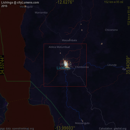
Analysis of Lichinga night lights 2016
Square area 10x10 km:
 6.82%
6.82%90-99
5.58%80-89
2.27%70-79
4.55%60-69
3.1%50-59
7.02%40-49
4.96%30-39
2.27%20-29
2.89%10-19
31.82%0-9
28.72%Square area 50x50 km:
0.27%90-99
0.22%80-89
0.09%70-79
0.18%60-69
0.14%50-59
0.35%40-49
0.25%30-39
0.17%20-29
0.12%10-19
1.61%0-9
96.59%Clear (daylight) street map image can be seen on geolist.org.
Map coordinates:
12° 37' 39.4" South, 34° 32' 14.8" East
13° 18' 46" South, 35° 14' 26" East
13° 59' 45.7" South, 35° 56' 37.3" East
Some cities around Lichinga sort by population:
• Mandimba
123.8 km =76.9 mi,  159°
159°
• Mangochi, MW
129.6 km =80.5 mi,  178°
178°
• Salima, MW
99.2 km =61.6 mi,  238°
238°
• Nkhotakota, MW
110.9 km =68.9 mi,  292°
292°
• Dedza, MW
153.7 km =95.5 mi,  219°
219°
• Monkey Bay, MW
92.5 km =57.5 mi,  202°
202°
• Ntchisi, MW
145.4 km =90.3 mi,  260°
260°
• Dowa, MW
145.9 km =90.7 mi,  254°
254°
1043893 (p: 109,839)
Sources (retrieved 2019-11-25):
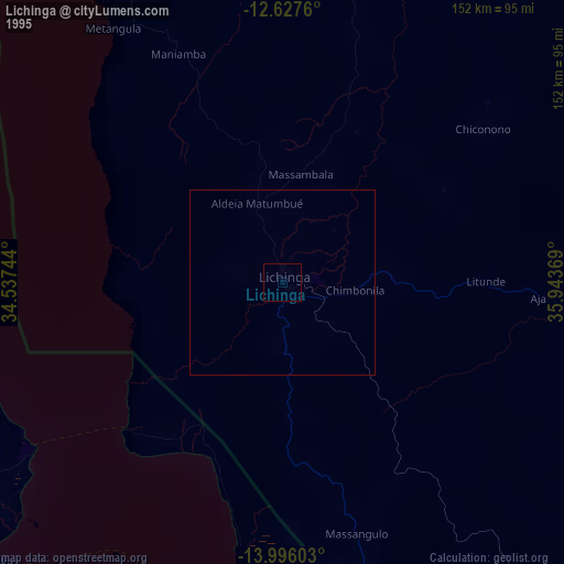
» NASA, Earths city lights 1995
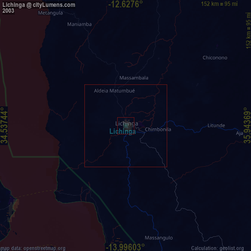
» NASA city lights 2003
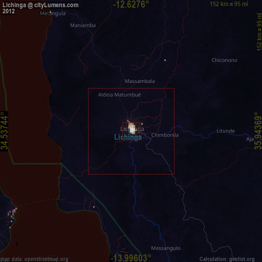
» Earth at Night: Flat Maps 2012, 2016