Ntchisi night lights from space
Night Light of Ntchisi (Central Region) from space (Malawi) Src. Average luminocity for 10x10km area is 0% and for 50x50km: 0.3714%.
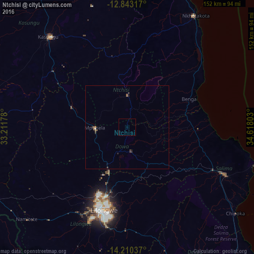
Analysis of Ntchisi night lights 2016
Square area 10x10 km:
 0%
0%90-99
0%80-89
0%70-79
0%60-69
0%50-59
0%40-49
0%30-39
0%20-29
0%10-19
0%0-9
100%Square area 50x50 km:
0.02%90-99
0.02%80-89
0%70-79
0.07%60-69
0.07%50-59
0.1%40-49
0.14%30-39
0.11%20-29
0.12%10-19
0.08%0-9
99.29%Clear (daylight) street map image can be seen on geolist.org.
Map coordinates:
12° 50' 35.4" South, 33° 12' 42.4" East
13° 31' 39.9" South, 33° 54' 53.6" East
14° 12' 37.3" South, 34° 37' 4.9" East
Some cities around Ntchisi sort by population:
• Lilongwe
50.7 km =31.5 mi,  195°
195°
• Kasungu
72.1 km =44.8 mi,  319°
319°
• Salima
65.1 km =40.5 mi,  115°
115°
• Nkhotakota
78.5 km =48.8 mi,  31°
31°
• Mchinji
115.8 km =72 mi,  254°
254°
• Dedza
104.8 km =65.1 mi,  154°
154°
• Mponela
18.9 km =11.7 mi,  268°
268°
• Dowa
14.2 km =8.8 mi,  170°
170°
924491 (p: 7,918)
Sources (retrieved 2019-11-25):
» Earth at Night: Flat Maps 2012, 2016