Dedza night lights from space
Night Light of Dedza (Central Region) from space (Malawi) Src. Average luminocity for 10x10km area is 8.79% and for 50x50km: 0.4257%.
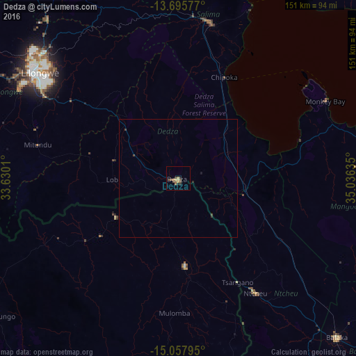
Analysis of Dedza night lights 2016
Square area 10x10 km:
 0%
0%90-99
0%80-89
2.16%70-79
0.43%60-69
2.81%50-59
3.25%40-49
2.6%30-39
0%20-29
2.6%10-19
0%0-9
86.15%Square area 50x50 km:
0%90-99
0%80-89
0.08%70-79
0.02%60-69
0.11%50-59
0.13%40-49
0.18%30-39
0.04%20-29
0.14%10-19
0.03%0-9
99.27%Clear (daylight) street map image can be seen on geolist.org.
Map coordinates:
13° 41' 44.8" South, 33° 37' 48.4" East
14° 22' 40.4" South, 34° 19' 59.6" East
15° 3' 28.6" South, 35° 2' 10.9" East
Some cities around Dedza sort by population:
• Lilongwe
74.5 km =46.3 mi,  307°
307°
• Mangochi
100.9 km =62.7 mi,  96°
96°
• Salima
67.8 km =42.1 mi,  11°
11°
• Balaka
94.6 km =58.8 mi,  134°
134°
• Monkey Bay
70.9 km =44.1 mi,  62°
62°
• Ntcheu
59 km =36.7 mi,  146°
146°
• Ntchisi
104.8 km =65.1 mi,  334°
334°
• Dowa
91.1 km =56.6 mi, 332°
930025 (p: 15,608)
Sources (retrieved 2019-11-25):
» Earth at Night: Flat Maps 2012, 2016