Mangochi night lights from space
Night Light of Mangochi (Southern Region) from space (Malawi) Src. Average luminocity for 10x10km area is 14.0563% and for 50x50km: 0.8741%.
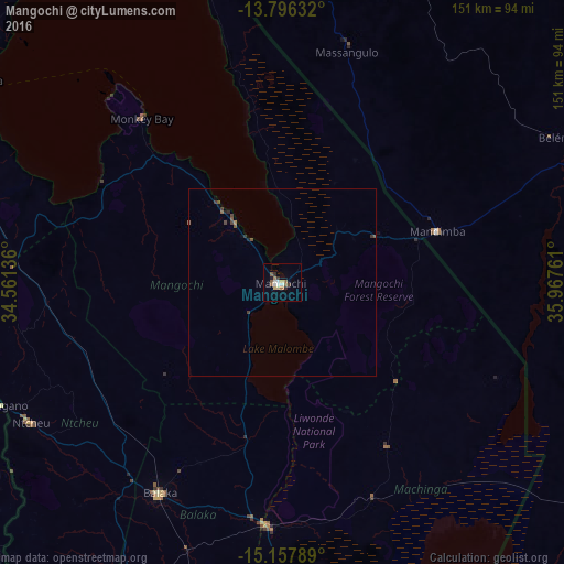
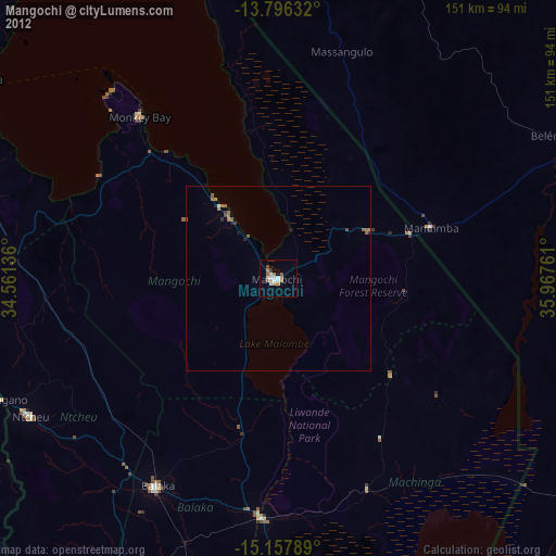
Analysis of Mangochi night lights 2016
Square area 10x10 km:
 2.6%
2.6%90-99
1.73%80-89
1.52%70-79
1.08%60-69
3.03%50-59
3.03%40-49
0%30-39
2.16%20-29
1.3%10-19
0.87%0-9
82.68%Square area 50x50 km:
0.1%90-99
0.07%80-89
0.06%70-79
0.04%60-69
0.17%50-59
0.27%40-49
0.13%30-39
0.24%20-29
0.11%10-19
0.13%0-9
98.68%Clear (daylight) street map image can be seen on geolist.org.
Map coordinates:
13° 47' 46.8" South, 34° 33' 40.9" East
14° 28' 41.3" South, 35° 15' 52.1" East
15° 9' 28.4" South, 35° 58' 3.4" East
Some cities around Mangochi sort by population:
• Mandimba, MZ
43.9 km =27.3 mi,  71°
71°
• Zomba
101.1 km =62.8 mi,  176°
176°
• Salima
116.5 km =72.4 mi,  311°
311°
• Liwonde
65.6 km =40.8 mi, 183°
• Balaka
64.9 km =40.3 mi,  210°
210°
• Dedza
100.9 km =62.7 mi,  276°
276°
• Monkey Bay
57.8 km =35.9 mi,  319°
319°
• Ntcheu
77.6 km =48.2 mi,  240°
240°
927246 (p: 40,236)
Sources (retrieved 2019-11-25):
» Earth at Night: Flat Maps 2012, 2016