Monkey Bay night lights from space
Night Light of Monkey Bay (Southern Region) from space (Malawi) Src. Average luminocity for 10x10km area is 1.7511% and for 50x50km: 0.162%.
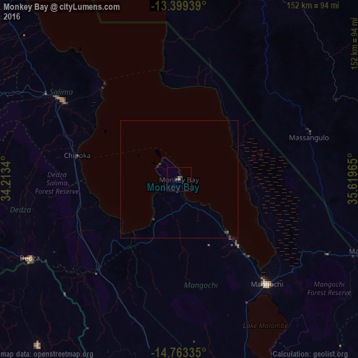
Analysis of Monkey Bay night lights 2016
Square area 10x10 km:
 0%
0%90-99
0%80-89
0%70-79
0%60-69
0.22%50-59
1.73%40-49
0.65%30-39
0.87%20-29
0%10-19
0%0-9
96.54%Square area 50x50 km:
0%90-99
0%80-89
0%70-79
0%60-69
0.01%50-59
0.1%40-49
0.03%30-39
0.17%20-29
0.03%10-19
0.05%0-9
99.62%Clear (daylight) street map image can be seen on geolist.org.
Map coordinates:
13° 23' 57.8" South, 34° 12' 48.2" East
14° 4' 56.6" South, 34° 54' 59.5" East
14° 45' 48.1" South, 35° 37' 10.7" East
Some cities around Monkey Bay sort by population:
• Mandimba, MZ
84.6 km =52.6 mi,  110°
110°
• Lichinga, MZ
92.5 km =57.5 mi,  22°
22°
• Mangochi
57.8 km =35.9 mi,  139°
139°
• Salima
59.7 km =37.1 mi,  304°
304°
• Liwonde
114.4 km =71.1 mi,  163°
163°
• Balaka
99.8 km =62 mi,  177°
177°
• Dedza
70.9 km =44.1 mi,  242°
242°
• Ntcheu
87.4 km =54.3 mi,  200°
200°
926308 (p: 11,619)
Sources (retrieved 2019-11-25):
» Earth at Night: Flat Maps 2012, 2016