Ciudad López Mateos night lights from space
Night Light of Ciudad López Mateos (México) from space (Mexico) Src. Average luminocity for 10x10km area is 94.7066% and for 50x50km: 70.5756%.
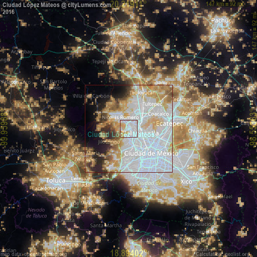
Analysis of Ciudad López Mateos night lights 2016
Square area 10x10 km:
 52.69%
90-99
22.73%80-89
13.84%70-79
10.33%60-69
0.41%50-59
0%40-49
0%30-39
0%20-29
0%10-19
0%0-9
0%Square area 50x50 km:
35.75%90-99
11.27%80-89
8.68%70-79
7.97%60-69
5.9%50-59
3.62%40-49
3.18%30-39
2.82%20-29
5.08%10-19
5.54%0-9
10.2%Clear (daylight) street map image can be seen on geolist.org.
Map coordinates:
20° 13' 8.8" North, 99° 57' 35.6" West
19° 33' 28.5" North, 99° 15' 24.3" West
18° 53' 38.5" North, 98° 33' 13.1" West
Some cities around Ciudad López Mateos sort by population:
• Naucalpan de Juárez
9 km =5.6 mi,  168°
168°
• Tlalnepantla
6.7 km =4.2 mi,  107°
107°
• Cuautitlán Izcalli
10.5 km =6.5 mi,  24°
24°
• Azcapotzalco
10.8 km =6.7 mi,  136°
136°
• Nicolás Romero
10.7 km =6.6 mi,  330°
330°
• Buenavista
10.7 km =6.6 mi,  58°
58°
• Veintidós de Febrero
11.1 km =6.9 mi,  302°
302°
• Vista Hermosa
5.8 km =3.6 mi, 142°
3532624 (p: 489,160)
Sources (retrieved 2019-11-25):
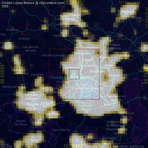
» NASA, Earths city lights 1995
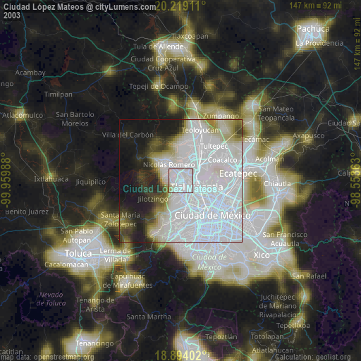
» NASA city lights 2003
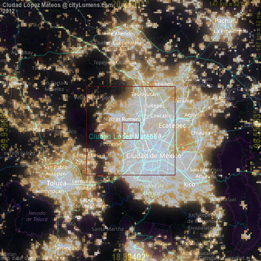
» Earth at Night: Flat Maps 2012, 2016