Nicolás Romero night lights from space
Night Light of Nicolás Romero (México) from space (Mexico) Src. Average luminocity for 10x10km area is 83.624% and for 50x50km: 55.485%.
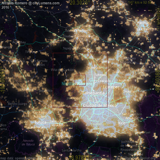
Analysis of Nicolás Romero night lights 2016
Square area 10x10 km:
 24.38%
90-99
19.83%80-89
21.69%70-79
12.81%60-69
7.85%50-59
9.71%40-49
3.72%30-39
0%20-29
0%10-19
0%0-9
0%Square area 50x50 km:
21.85%90-99
9.14%80-89
8.11%70-79
7.42%60-69
6.57%50-59
4.4%40-49
3.93%30-39
3.85%20-29
4.45%10-19
7.14%0-9
23.14%Clear (daylight) street map image can be seen on geolist.org.
Map coordinates:
20° 18' 9.4" North, 100° 0' 35.7" West
19° 38' 30.4" North, 99° 18' 24.5" West
18° 58' 41.6" North, 98° 36' 13.2" West
Some cities around Nicolás Romero sort by population:
• Ciudad López Mateos
10.7 km =6.6 mi,  150°
150°
• Cuautitlán Izcalli
9.5 km =5.9 mi,  88°
88°
• Huilango
6.8 km =4.2 mi,  50°
50°
• Veintidós de Febrero
5.4 km =3.4 mi,  231°
231°
• Progreso Industrial
5.3 km =3.3 mi,  263°
263°
• Santiago Cuautlalpan
5.1 km =3.2 mi,  21°
21°
• San Mateo Xoloc
9.5 km =5.9 mi,  40°
40°
• San José el Vidrio
8.2 km =5.1 mi,  279°
279°
3522732 (p: 281,799)
Sources (retrieved 2019-11-25):
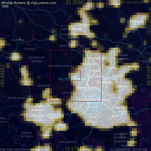
» NASA, Earths city lights 1995
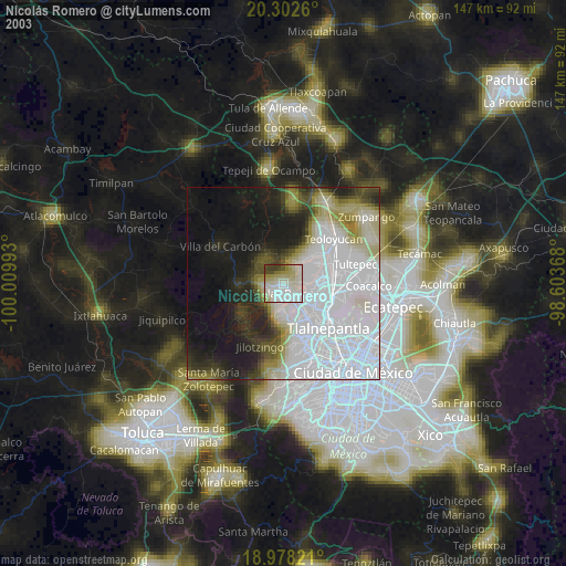
» NASA city lights 2003
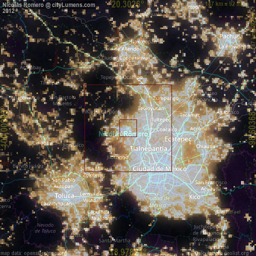
» Earth at Night: Flat Maps 2012, 2016