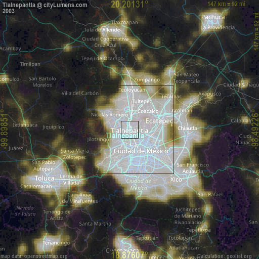
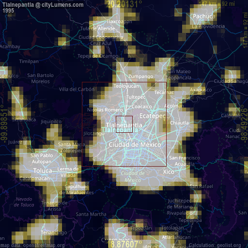
Tlalnepantla night lights from space
Night Light of Tlalnepantla (México) from space (Mexico) Src. Average luminocity for 10x10km area is 98.4814% and for 50x50km: 80.0581%.
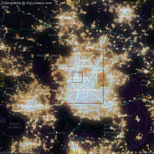
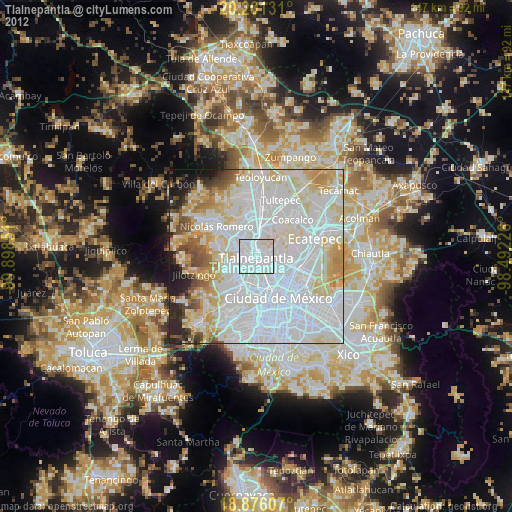
Analysis of Tlalnepantla night lights 2016
Square area 10x10 km:
 72.31%
90-99
20.04%80-89
7.64%70-79
0%60-69
0%50-59
0%40-49
0%30-39
0%20-29
0%10-19
0%0-9
0%Square area 50x50 km:
42.04%90-99
13.57%80-89
10.19%70-79
8.89%60-69
5.88%50-59
3.57%40-49
2.79%30-39
2.36%20-29
4.59%10-19
3.74%0-9
2.38%Clear (daylight) street map image can be seen on geolist.org.
Map coordinates:
20° 12' 4.7" North, 99° 53' 54.6" West
19° 32' 24.2" North, 99° 11' 43.4" West
18° 52' 33.9" North, 98° 29' 32.1" West
Some cities around Tlalnepantla sort by population:
• Gustavo Adolfo Madero
10.2 km =6.3 mi,  120°
120°
• Naucalpan de Juárez
8.3 km =5.2 mi,  214°
214°
• Ciudad López Mateos
6.7 km =4.2 mi,  287°
287°
• Azcapotzalco
6 km =3.7 mi,  170°
170°
• Buenavista
8.1 km =5 mi,  19°
19°
• Colonia Lindavista
9.2 km =5.7 mi,  126°
126°
• Ampliación San Mateo (Colonia Solidaridad)
9.9 km =6.2 mi,  30°
30°
• Vista Hermosa
4 km =2.5 mi,  227°
227°
3515431 (p: 653,410)
Sources (retrieved 2019-11-25):
» NASA, Earths city lights 1995
» NASA city lights 2003
» Earth at Night: Flat Maps 2012, 2016