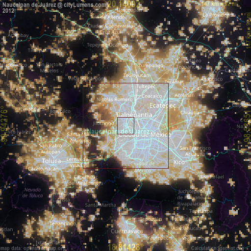
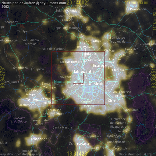
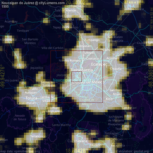
Naucalpan de Juárez night lights from space
Night Light of Naucalpan de Juárez (México) from space (Mexico) Src. Average luminocity for 10x10km area is 99.3264% and for 50x50km: 77.2776%.
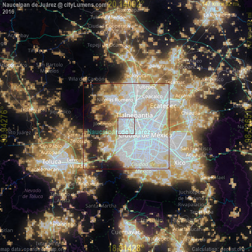
Analysis of Naucalpan de Juárez night lights 2016
Square area 10x10 km:
 74.79%
90-99
23.35%80-89
1.03%70-79
0.83%60-69
0%50-59
0%40-49
0%30-39
0%20-29
0%10-19
0%0-9
0%Square area 50x50 km:
42.39%90-99
12.65%80-89
9.44%70-79
6.49%60-69
4.87%50-59
3.18%40-49
3.33%30-39
3.13%20-29
5.68%10-19
5.08%0-9
3.76%Clear (daylight) street map image can be seen on geolist.org.
Map coordinates:
20° 8' 24.1" North, 99° 56' 33.9" West
19° 28' 42.6" North, 99° 14' 22.7" West
18° 48' 51.4" North, 98° 32' 11.4" West
Some cities around Naucalpan de Juárez sort by population:
• Tlalnepantla
8.3 km =5.2 mi,  34°
34°
• Cuauhtémoc
10.5 km =6.5 mi,  110°
110°
• Ciudad López Mateos
9 km =5.6 mi,  348°
348°
• Azcapotzalco
5.7 km =3.5 mi,  80°
80°
• Miguel Hidalgo
6.4 km =4 mi,  140°
140°
• Polanco
6.6 km =4.1 mi, 139°
• Col. Bosques de las Lomas
11.4 km =7.1 mi,  193°
193°
• Vista Hermosa
4.5 km =2.8 mi,  22°
22°
3522790 (p: 792,211)
Sources (retrieved 2019-11-25):
» NASA, Earths city lights 1995
» NASA city lights 2003
» Earth at Night: Flat Maps 2012, 2016