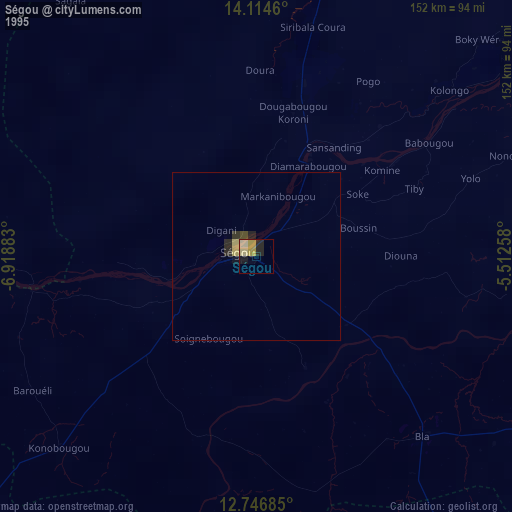
Ségou night lights from space
Night Light of Ségou from space (Mali) Src. Average luminocity for 10x10km area is 18.626% and for 50x50km: 1.4185%.
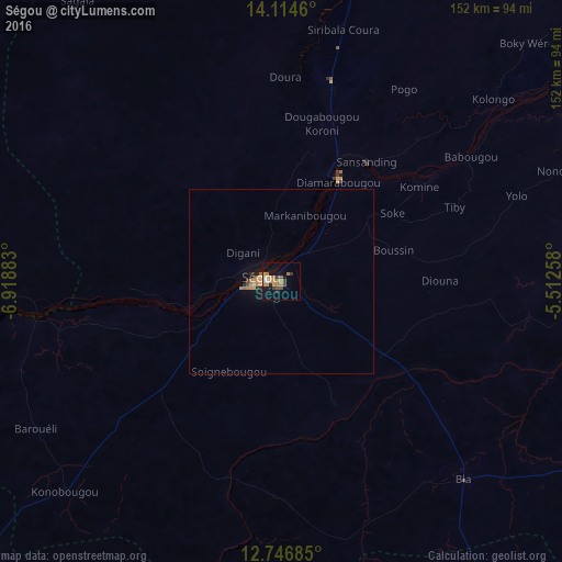
Analysis of Ségou night lights 2016
Square area 10x10 km:
 1.65%
1.65%90-99
0.83%80-89
1.03%70-79
5.58%60-69
4.96%50-59
1.86%40-49
2.07%30-39
2.69%20-29
2.48%10-19
15.5%0-9
61.36%Square area 50x50 km:
0.07%90-99
0.08%80-89
0.06%70-79
0.49%60-69
0.37%50-59
0.1%40-49
0.15%30-39
0.14%20-29
0.26%10-19
1.02%0-9
97.26%Clear (daylight) street map image can be seen on geolist.org.
Map coordinates:
14° 6' 52.6" North, 6° 55' 7.8" West
13° 25' 54.1" North, 6° 12' 56.5" West
12° 44' 48.7" North, 5° 30' 45.3" West
Some cities around Ségou sort by population:
• Koutiala
141.4 km =87.9 mi,  144°
144°
• Markala
34.1 km =21.2 mi,  28°
28°
• Banamba
133.9 km =83.2 mi,  275°
275°
• San
143.5 km =89.2 mi,  95°
95°
• Koulikoro
158.7 km =98.6 mi,  246°
246°
• Ké-Macina
110 km =68.4 mi,  57°
57°
• Ntossoni
111.2 km =69.1 mi,  154°
154°
• Kinmparana
154.4 km =95.9 mi,  115°
115°
2451478 (p: 92,552)
Sources (retrieved 2019-11-25):
» NASA, Earths city lights 1995
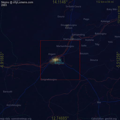
» NASA city lights 2003
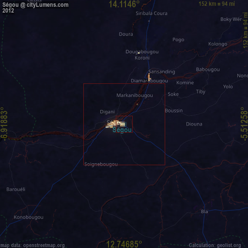
» Earth at Night: Flat Maps 2012, 2016