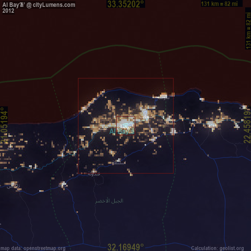
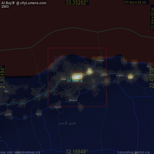
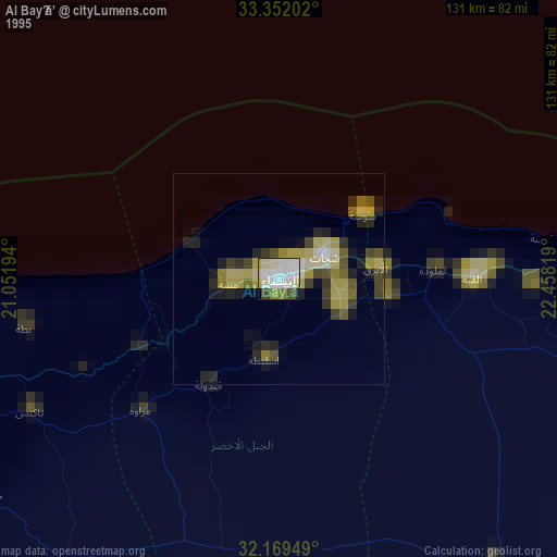
Al Bayḑā’ night lights from space
Night Light of Al Bayḑā’ (Al Jabal al Akhḑar) from space (Libya) Src. Average luminocity for 10x10km area is 75.0717% and for 50x50km: 18.0951%.
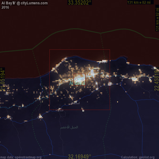
Analysis of Al Bayḑā’ night lights 2016
Square area 10x10 km:
 20.63%
90-99
22.9%80-89
6.12%70-79
7.52%60-69
13.64%50-59
10.84%40-49
9.09%30-39
4.9%20-29
4.37%10-19
0%0-9
0%Square area 50x50 km:
1.92%90-99
2.39%80-89
1.41%70-79
1.69%60-69
2.61%50-59
3.33%40-49
4.19%30-39
5.05%20-29
5.33%10-19
12.75%0-9
59.33%Clear (daylight) street map image can be seen on geolist.org.
Map coordinates:
33° 21' 7.3" North, 21° 3' 7" East
32° 45' 45.8" North, 21° 45' 18.2" East
32° 10' 10.2" North, 22° 27' 29.5" East
Some cities around Al Bayḑā’ sort by population:
• Benghazi
173.9 km =108.1 mi,  245°
245°
• Tobruk
219.5 km =136.4 mi,  109°
109°
• Al Marj
91.8 km =57 mi, 250°
• Darnah
82.4 km =51.2 mi,  89°
89°
• Al Abyār
126 km =78.3 mi,  239°
239°
• Al Qubbah
45.4 km =28.2 mi, 90°
• Tūkrah
113 km =70.2 mi,  257°
257°
• Qaryat Sulūq
186.6 km =115.9 mi,  229°
229°
89055 (p: 74,594)
Sources (retrieved 2019-11-25):
» NASA, Earths city lights 1995
» NASA city lights 2003
» Earth at Night: Flat Maps 2012, 2016