Ajdabiya night lights from space
Night Light of Ajdabiya (Al Wāḩāt) from space (Libya) Src. Average luminocity for 10x10km area is 67.6941% and for 50x50km: 4.8274%.
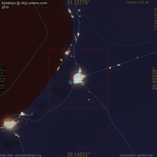
Analysis of Ajdabiya night lights 2016
Square area 10x10 km:
 28.15%
90-99
18.88%80-89
5.94%70-79
2.97%60-69
0.87%50-59
5.77%40-49
4.2%30-39
8.39%20-29
18.88%10-19
5.94%0-9
0%Square area 50x50 km:
1.31%90-99
1.09%80-89
0.37%70-79
0.25%60-69
0.12%50-59
0.41%40-49
0.55%30-39
0.57%20-29
1.37%10-19
3.15%0-9
90.79%Clear (daylight) street map image can be seen on geolist.org.
Map coordinates:
31° 21' 28" North, 19° 31' 23.3" East
30° 45' 19.6" North, 20° 13' 34.5" East
30° 8' 57.6" North, 20° 55' 45.8" East
Some cities around Ajdabiya sort by population:
• Benghazi
151.9 km =94.4 mi,  354°
354°
• Al Marj
201.4 km =125.1 mi,  16°
16°
• Al Abyār
163.3 km =101.5 mi,  12°
12°
• Tūkrah
200.6 km =124.6 mi, 9°
• Az Zuwaytīnah
24.1 km =15 mi,  335°
335°
• Qaryat Sulūq
101.5 km =63.1 mi,  1°
1°
• Al Burayqah
73.5 km =45.7 mi,  238°
238°
• Awjilah
209.8 km =130.4 mi,  150°
150°
89113 (p: 134,358)
Sources (retrieved 2019-11-25):
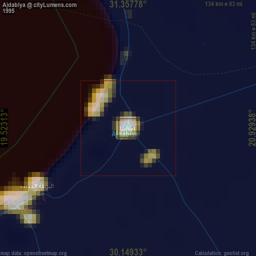
» NASA, Earths city lights 1995
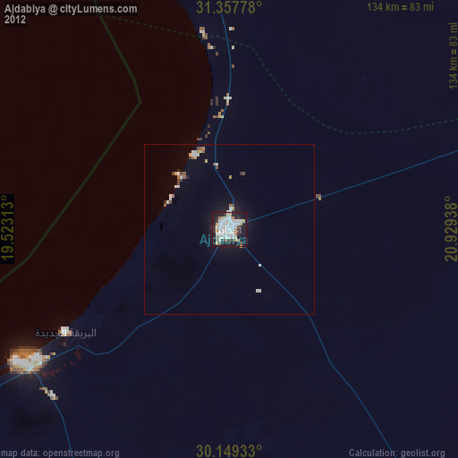
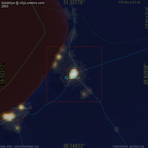
» NASA city lights 2003
» Earth at Night: Flat Maps 2012, 2016