Karatsu night lights from space
Night Light of Karatsu (Saga) from space (Japan) Src. Average luminocity for 10x10km area is 22.993% and for 50x50km: 5.4606%.
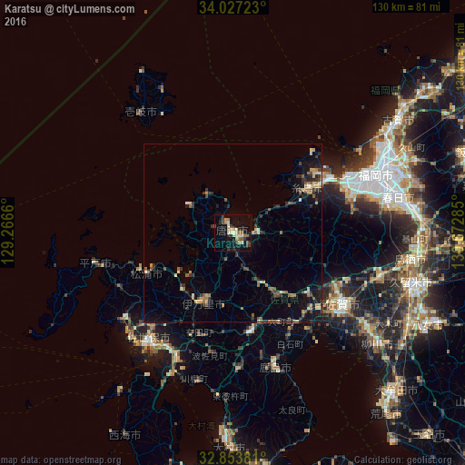
Analysis of Karatsu night lights 2016
Square area 10x10 km:
 0%
0%90-99
3.15%80-89
5.59%70-79
2.8%60-69
3.15%50-59
3.67%40-49
2.27%30-39
3.67%20-29
4.72%10-19
24.65%0-9
46.33%Square area 50x50 km:
0.08%90-99
0.49%80-89
0.83%70-79
0.67%60-69
0.78%50-59
0.96%40-49
0.77%30-39
1.4%20-29
1.28%10-19
3.79%0-9
88.96%Clear (daylight) street map image can be seen on geolist.org.
Map coordinates:
34° 1' 38" North, 129° 15' 59.8" East
33° 26' 33" North, 129° 58' 11" East
32° 51' 13.7" North, 130° 40' 22.3" East
Some cities around Karatsu sort by population:
• Sasebo
38 km =23.6 mi,  216°
216°
• Saga
38.5 km =23.9 mi,  127°
127°
• Maebaru-chūō
25.1 km =15.6 mi,  58°
58°
• Imarichō-kō
20.6 km =12.8 mi,  204°
204°
• Takeochō-takeo
28.5 km =17.7 mi,  170°
170°
• Kashima
39.1 km =24.3 mi,  163°
163°
• Hirado
39.6 km =24.6 mi,  258°
258°
• Ureshinomachi-shimojuku
36.7 km =22.8 mi,  175°
175°
1860063 (p: 78,330)
Sources (retrieved 2019-11-25):
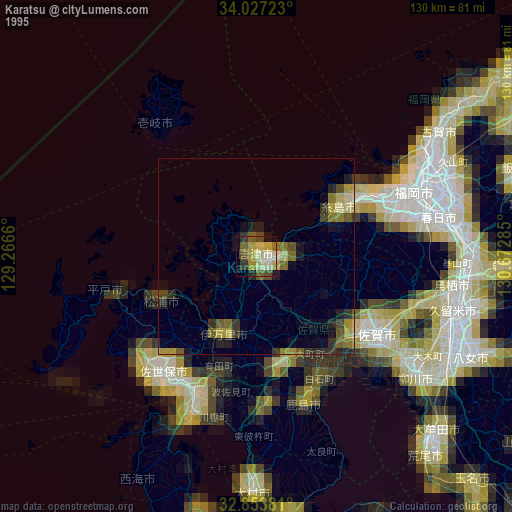
» NASA, Earths city lights 1995
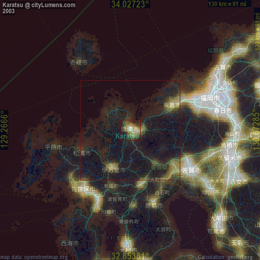
» NASA city lights 2003
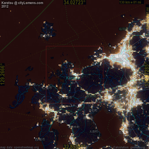
» Earth at Night: Flat Maps 2012, 2016