Saga night lights from space
Night Light of Saga from space (Japan) Src. Average luminocity for 10x10km area is 42.6538% and for 50x50km: 18.5624%.
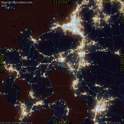
Analysis of Saga night lights 2016
Square area 10x10 km:
 4.37%
4.37%90-99
8.74%80-89
5.42%70-79
5.94%60-69
8.22%50-59
5.42%40-49
2.62%30-39
9.09%20-29
19.76%10-19
23.25%0-9
7.17%Square area 50x50 km:
1.03%90-99
2.61%80-89
2.53%70-79
2.38%60-69
3.25%50-59
3.74%40-49
2.88%30-39
3.65%20-29
6.44%10-19
12.75%0-9
58.73%Clear (daylight) street map image can be seen on geolist.org.
Map coordinates:
33° 49' 10.1" North, 129° 35' 48.8" East
33° 13' 60" North, 130° 18' 0" East
32° 38' 35.6" North, 131° 0' 11.3" East
Some cities around Saga sort by population:
• Kurume
22.2 km =13.8 mi,  65°
65°
• Ōmuta
26.3 km =16.3 mi,  147°
147°
• Tosu
25 km =15.5 mi,  53°
53°
• Yanagawa
11.9 km =7.4 mi,  128°
128°
• Ōkawa
7.6 km =4.7 mi,  113°
113°
• Kashima
24.1 km =15 mi,  234°
234°
• Setakamachi-takayanagi
18.1 km =11.2 mi,  121°
121°
• Kanzakimachi-kanzaki
10.9 km =6.8 mi,  39°
39°
1853303 (p: 165,236)
Sources (retrieved 2019-11-25):
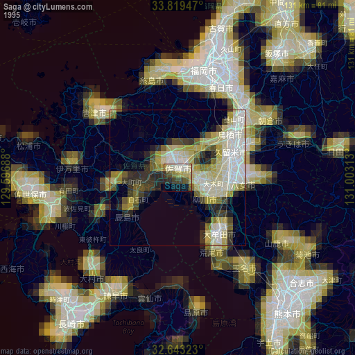
» NASA, Earths city lights 1995
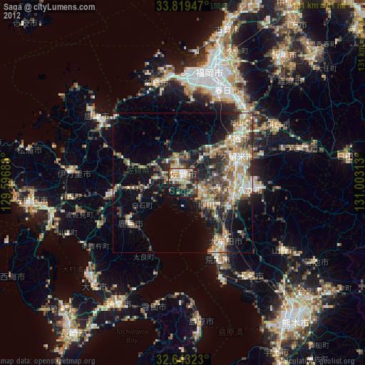
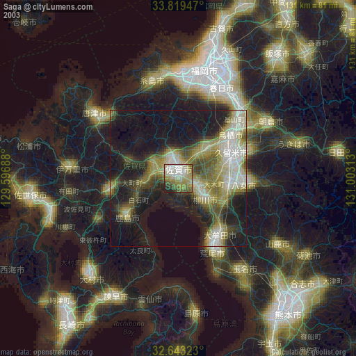
» NASA city lights 2003
» Earth at Night: Flat Maps 2012, 2016