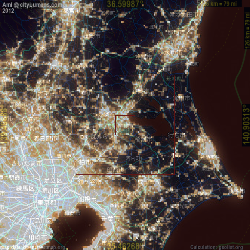
Ami night lights from space
Night Light of Ami (Ibaraki) from space (Japan) Src. Average luminocity for 10x10km area is 52.13% and for 50x50km: 29.0324%.
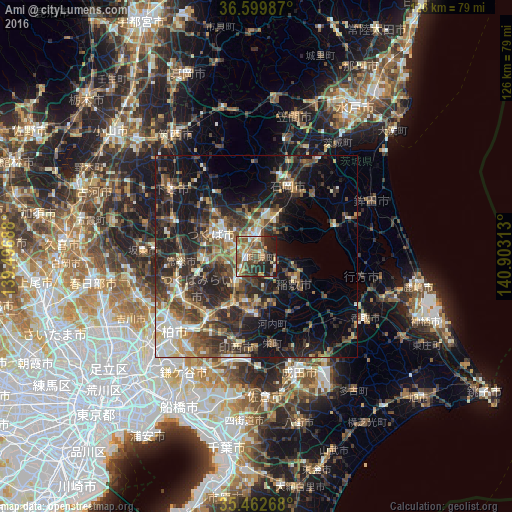
Analysis of Ami night lights 2016
Square area 10x10 km:
100  4.21%
4.21%
90-99 6.04%
80-89 5.31%
70-79 11.36%
60-69 8.79%
50-59 15.75%
40-49 15.93%
30-39 3.85%
20-29 21.61%
10-19 7.14%
0-9 0%
4.21%90-99
6.04%80-89
5.31%70-79
11.36%60-69
8.79%50-59
15.75%40-49
15.93%30-39
3.85%20-29
21.61%10-19
7.14%0-9
0%Square area 50x50 km:
100 2.65%
90-99 4.42%
80-89 2.55%
70-79 3.42%
60-69 4.35%
50-59 5.26%
40-49 6.58%
30-39 7.94%
20-29 11.14%
10-19 16.77%
0-9 34.94%
2.65%90-99
4.42%80-89
2.55%70-79
3.42%60-69
4.35%50-59
5.26%40-49
6.58%30-39
7.94%20-29
11.14%10-19
16.77%0-9
34.94%Clear (daylight) street map image can be seen on geolist.org.
Map coordinates:
36° 35' 59.5" North, 139° 29' 48.8" East
36° 1' 60" North, 140° 12' 0" East
35° 27' 45.6" North, 140° 54' 11.3" East
Some cities around Ami sort by population:
• Ryūgasaki
14.9 km =9.3 mi,  185°
185°
• Toride
18.2 km =11.3 mi,  215°
215°
• Ushiku
9.5 km =5.9 mi, 218°
• Ishioka
17.7 km =11 mi,  19°
19°
• Inashiki
14 km =8.7 mi,  127°
127°
• Naka
3.5 km =2.2 mi,  301°
301°
• Fujishiro
15 km =9.3 mi,  210°
210°
• Edosaki
14 km =8.7 mi, 131°
2113115 (p: 48,256)
Sources (retrieved 2019-11-25):
» Earth at Night: Flat Maps 2012, 2016