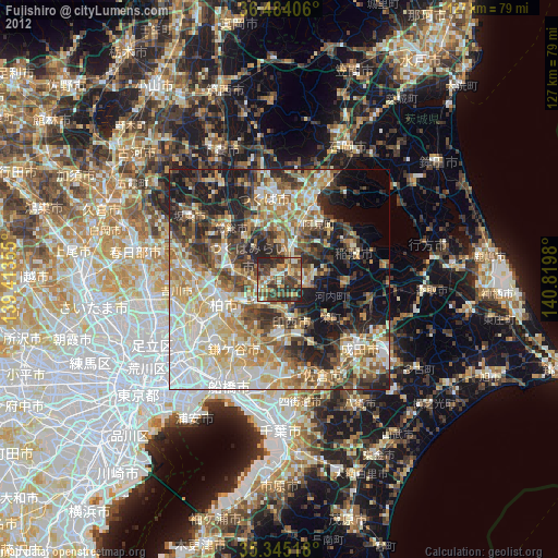
Fujishiro night lights from space
Night Light of Fujishiro (Ibaraki) from space (Japan) Src. Average luminocity for 10x10km area is 41.2527% and for 50x50km: 49.4254%.
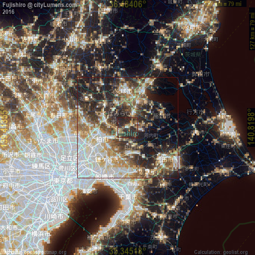
Analysis of Fujishiro night lights 2016
Square area 10x10 km:
100  2.38%
2.38%
90-99 2.93%
80-89 2.56%
70-79 6.59%
60-69 6.96%
50-59 7.51%
40-49 8.97%
30-39 18.86%
20-29 38.1%
10-19 5.13%
0-9 0%
2.38%90-99
2.93%80-89
2.56%70-79
6.59%60-69
6.96%50-59
7.51%40-49
8.97%30-39
18.86%20-29
38.1%10-19
5.13%0-9
0%Square area 50x50 km:
100 10.41%
90-99 10.8%
80-89 5.29%
70-79 5.77%
60-69 6.6%
50-59 7.15%
40-49 8.03%
30-39 8.66%
20-29 12.66%
10-19 11.24%
0-9 13.39%
10.41%90-99
10.8%80-89
5.29%70-79
5.77%60-69
6.6%50-59
7.15%40-49
8.03%30-39
8.66%20-29
12.66%10-19
11.24%0-9
13.39%Clear (daylight) street map image can be seen on geolist.org.
Map coordinates:
36° 29' 2.6" North, 139° 24' 48.8" East
35° 55' 0" North, 140° 7' 0" East
35° 20' 42.6" North, 140° 49' 11.3" East
Some cities around Fujishiro sort by population:
• Kashiwa
13.9 km =8.6 mi,  244°
244°
• Abiko
10.6 km =6.6 mi, 238°
• Ryūgasaki
6.3 km =3.9 mi,  107°
107°
• Toride
3.5 km =2.2 mi, 238°
• Ushiku
5.8 km =3.6 mi,  15°
15°
• Moriya
10.7 km =6.6 mi,  280°
280°
• Shiroi
13.7 km =8.5 mi,  199°
199°
• Ami
15 km =9.3 mi,  30°
30°
2112940 (p: 33,148)
Sources (retrieved 2019-11-25):
» Earth at Night: Flat Maps 2012, 2016