Ryūgasaki night lights from space
Night Light of Ryūgasaki (Ibaraki) from space (Japan) Src. Average luminocity for 10x10km area is 35.1868% and for 50x50km: 44.0455%.
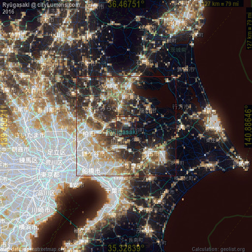
Analysis of Ryūgasaki night lights 2016
Square area 10x10 km:
 1.47%
1.47%90-99
3.11%80-89
4.21%70-79
5.13%60-69
4.4%50-59
5.68%40-49
9.52%30-39
11.36%20-29
19.78%10-19
28.21%0-9
7.14%Square area 50x50 km:
7.9%90-99
9.76%80-89
4.94%70-79
5.22%60-69
5.64%50-59
6.49%40-49
7.88%30-39
8.35%20-29
12.1%10-19
10.83%0-9
20.9%Clear (daylight) street map image can be seen on geolist.org.
Map coordinates:
36° 28' 3" North, 139° 28' 48.8" East
35° 54' 0" North, 140° 10' 60" East
35° 19' 42.2" North, 140° 53' 11.3" East
Some cities around Ryūgasaki sort by population:
• Abiko
15.5 km =9.6 mi,  256°
256°
• Toride
9 km =5.6 mi,  270°
270°
• Ushiku
8.7 km =5.4 mi,  328°
328°
• Shiroi
15.3 km =9.5 mi,  223°
223°
• Ami
14.9 km =9.3 mi,  5°
5°
• Inashiki
14.1 km =8.8 mi,  63°
63°
• Fujishiro
6.3 km =3.9 mi,  287°
287°
• Edosaki
13.2 km =8.2 mi,  65°
65°
2111258 (p: 85,761)
Sources (retrieved 2019-11-25):
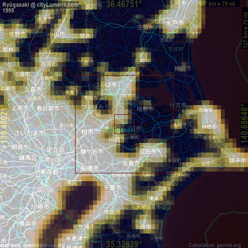
» NASA, Earths city lights 1995
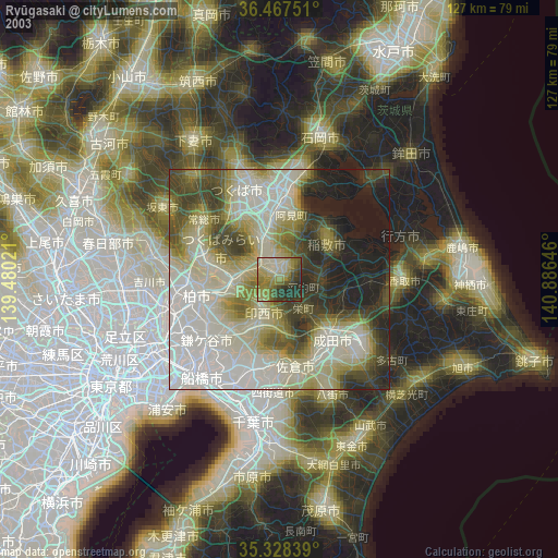
» NASA city lights 2003
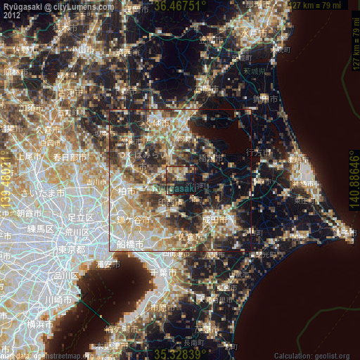
» Earth at Night: Flat Maps 2012, 2016