Al Azraq ash Shamālī night lights from space
Night Light of Al Azraq ash Shamālī (Zarqa) from space (Jordan) Src. Average luminocity for 10x10km area is 13.4066% and for 50x50km: 1.0369%.
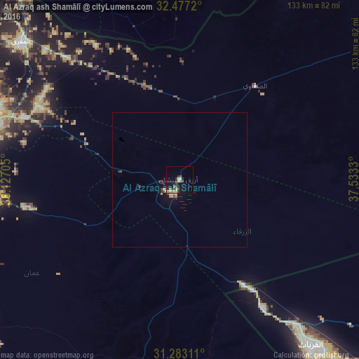
Analysis of Al Azraq ash Shamālī night lights 2016
Square area 10x10 km:
 0%
0%90-99
1.28%80-89
3.11%70-79
1.83%60-69
2.01%50-59
2.01%40-49
2.01%30-39
4.21%20-29
1.83%10-19
8.97%0-9
72.71%Square area 50x50 km:
0.03%90-99
0.08%80-89
0.25%70-79
0.13%60-69
0.11%50-59
0.1%40-49
0.24%30-39
0.28%20-29
0.15%10-19
0.54%0-9
98.09%Clear (daylight) street map image can be seen on geolist.org.
Map coordinates:
32° 28' 37.9" North, 36° 7' 37.4" East
31° 52' 55.5" North, 36° 49' 48.6" East
31° 16' 59.2" North, 37° 31' 59.9" East
Some cities around Al Azraq ash Shamālī sort by population:
• Amman
83.9 km =52.1 mi,  275°
275°
• Zarqa
73.1 km =45.4 mi,  286°
286°
• Russeifa
75.5 km =46.9 mi, 281°
• Qurayyat, SA
78.1 km =48.5 mi,  141°
141°
• Mafraq
77.8 km =48.3 mi,  311°
311°
• Saḩāb
77.9 km =48.4 mi,  269°
269°
• Ḩayy al Quwaysimah
83.2 km =51.7 mi, 272°
• Şabḩā
58.3 km =36.2 mi,  327°
327°
250095 (p: 14,800)
Sources (retrieved 2019-11-25):
» Earth at Night: Flat Maps 2012, 2016