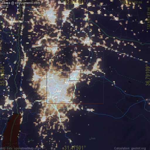
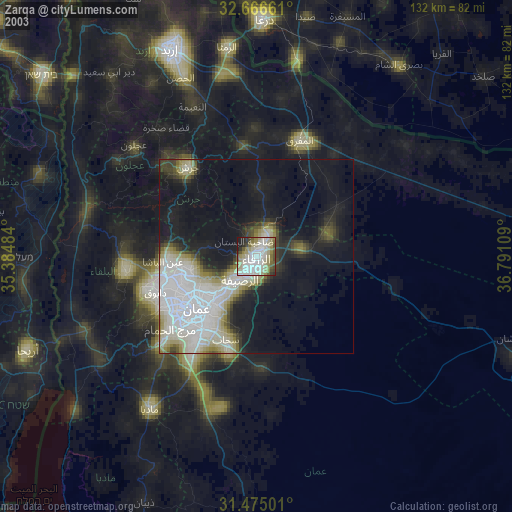
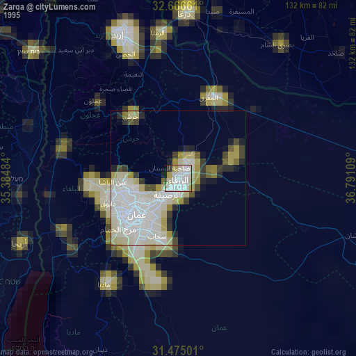
Zarqa night lights from space
Night Light of Zarqa from space (Jordan) Src. Average luminocity for 10x10km area is 84.8864% and for 50x50km: 46.4975%.
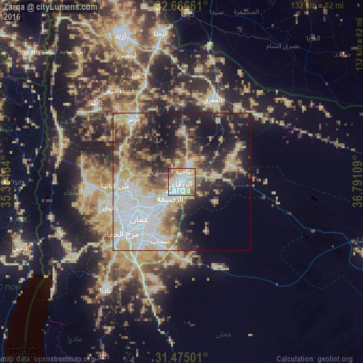
Analysis of Zarqa night lights 2016
Square area 10x10 km:
 26.4%
26.4%90-99
26.4%80-89
13.81%70-79
13.11%60-69
9.09%50-59
5.77%40-49
2.97%30-39
2.27%20-29
0.17%10-19
0%0-9
0%Square area 50x50 km:
11.4%90-99
8.93%80-89
8.24%70-79
6.46%60-69
3.89%50-59
4.45%40-49
6.45%30-39
6.26%20-29
9.12%10-19
14.48%0-9
20.32%Clear (daylight) street map image can be seen on geolist.org.
Map coordinates:
32° 39' 59.8" North, 35° 23' 5.4" East
32° 4' 21.9" North, 36° 5' 16.7" East
31° 28' 30" North, 36° 47' 27.9" East
Some cities around Zarqa sort by population:
• Amman
18.8 km =11.7 mi,  225°
225°
• Russeifa
7.3 km =4.5 mi,  212°
212°
• Al Jubayhah
19.2 km =11.9 mi,  248°
248°
• Saḩāb
23.8 km =14.8 mi,  199°
199°
• Ḩayy al Quwaysimah
22.3 km =13.9 mi,  215°
215°
• Jāwā
28.2 km =17.5 mi, 209°
• Rehab
27.9 km =17.3 mi,  0°
0°
• Ḩayy al Bunayyāt
27.5 km =17.1 mi, 224°
250090 (p: 792,665)
Sources (retrieved 2019-11-25):
» NASA, Earths city lights 1995
» NASA city lights 2003
» Earth at Night: Flat Maps 2012, 2016