Ḩayy al Quwaysimah night lights from space
Night Light of Ḩayy al Quwaysimah (Amman) from space (Jordan) Src. Average luminocity for 10x10km area is 98.514% and for 50x50km: 56.9245%.
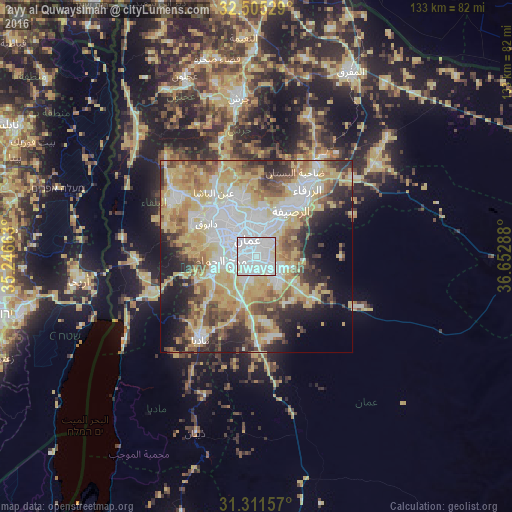
Analysis of Ḩayy al Quwaysimah night lights 2016
Square area 10x10 km:
 64.86%
90-99
29.02%80-89
6.12%70-79
0%60-69
0%50-59
0%40-49
0%30-39
0%20-29
0%10-19
0%0-9
0%Square area 50x50 km:
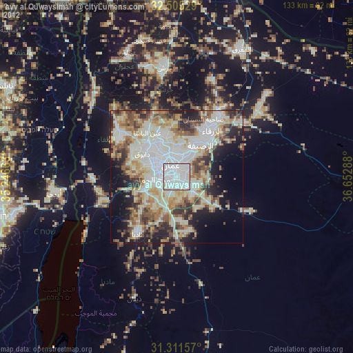
12.55%90-99
10.83%80-89
12.65%70-79
10.66%60-69
5.75%50-59
6.12%40-49
6.86%30-39
5.03%20-29
7.62%10-19
8.44%0-9
13.49%Clear (daylight) street map image can be seen on geolist.org.
Map coordinates:
32° 30' 19" North, 35° 14' 47.9" East
31° 54' 37.3" North, 35° 56' 59.1" East
31° 18' 41.7" North, 36° 39' 10.4" East
Some cities around Ḩayy al Quwaysimah sort by population:
• Amman
5 km =3.1 mi,  354°
354°
• Zarqa
22.3 km =13.9 mi,  35°
35°
• Russeifa
15 km =9.3 mi, 37°
• Wādī as Sīr
13.3 km =8.3 mi,  291°
291°
• Al Jubayhah
12.2 km =7.6 mi,  336°
336°
• Saḩāb
6.8 km =4.2 mi,  130°
130°
• Umm as Summāq
9.4 km =5.8 mi,  252°
252°
• Jāwā
6.5 km =4 mi,  188°
188°
250461 (p: 32,396)
Sources (retrieved 2019-11-25):
» Earth at Night: Flat Maps 2012, 2016