Qurayyat night lights from space
Night Light of Qurayyat (Al Jawf) from space (Saudi Arabia) Src. Average luminocity for 10x10km area is 76.9615% and for 50x50km: 11.7859%.
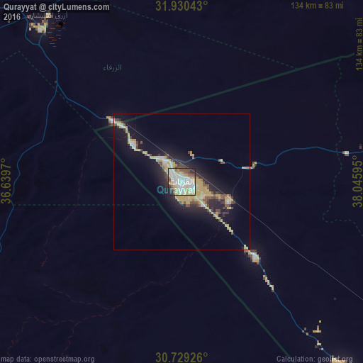
Analysis of Qurayyat night lights 2016
Square area 10x10 km:
 24.3%
24.3%90-99
23.43%80-89
10.66%70-79
12.24%60-69
1.75%50-59
5.77%40-49
9.62%30-39
2.45%20-29
8.74%10-19
1.05%0-9
0%Square area 50x50 km:
1.54%90-99
1.64%80-89
1.62%70-79
3.52%60-69
0.28%50-59
0.93%40-49
1.74%30-39
1.22%20-29
3.24%10-19
8.34%0-9
75.93%Clear (daylight) street map image can be seen on geolist.org.
Map coordinates:
31° 55' 49.5" North, 36° 38' 22.9" East
31° 19' 54.3" North, 37° 20' 34.2" East
30° 43' 45.3" North, 38° 2' 45.4" East
Some cities around Qurayyat sort by population:
• Zarqa, JO
144.5 km =89.8 mi,  304°
304°
• Russeifa, JO
144.5 km =89.8 mi, 301°
• Turaif
130.8 km =81.3 mi,  73°
73°
• Saḩāb, JO
140.1 km =87.1 mi, 295°
• Ţubarjal
124.5 km =77.4 mi,  137°
137°
• Al Azraq ash Shamālī, JO
78.1 km =48.5 mi,  321°
321°
• Jāwā, JO
145 km =90.1 mi,  293°
293°
• Şabḩā, JO
136.2 km =84.6 mi, 324°
108648 (p: 102,903)
Sources (retrieved 2019-11-25):
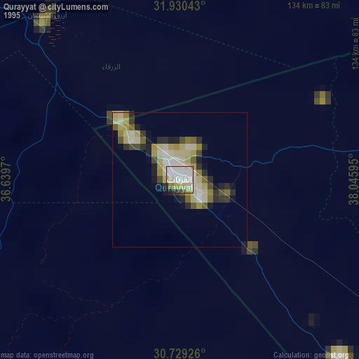
» NASA, Earths city lights 1995
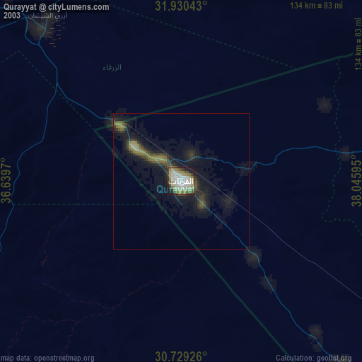
» NASA city lights 2003
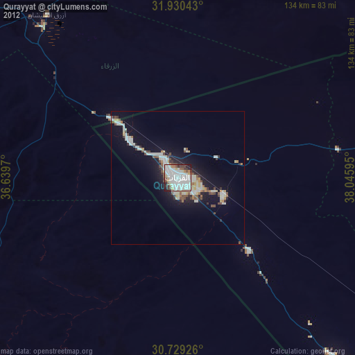
» Earth at Night: Flat Maps 2012, 2016