Şabḩā night lights from space
Night Light of Şabḩā (Mafraq) from space (Jordan) Src. Average luminocity for 10x10km area is 20.1062% and for 50x50km: 9.8807%.
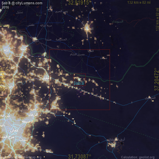
Analysis of Şabḩā night lights 2016
Square area 10x10 km:
 0.37%
0.37%90-99
0.92%80-89
4.76%70-79
2.75%60-69
2.2%50-59
1.28%40-49
5.31%30-39
4.58%20-29
1.83%10-19
29.12%0-9
46.89%Square area 50x50 km:
0.26%90-99
0.42%80-89
2.07%70-79
1.71%60-69
0.92%50-59
0.99%40-49
2.07%30-39
2.67%20-29
3.53%10-19
10.35%0-9
75.01%Clear (daylight) street map image can be seen on geolist.org.
Map coordinates:
32° 55' 8.9" North, 35° 47' 54.5" East
32° 19' 37.1" North, 36° 30' 5.7" East
31° 43' 51.1" North, 37° 12' 17" East
Some cities around Şabḩā sort by population:
• Zarqa
48.1 km =29.9 mi,  234°
234°
• Dar‘ā, SY
49.6 km =30.8 mi,  310°
310°
• Ar Ramthā
53 km =32.9 mi,  299°
299°
• As-Suwayda, SY
42.9 km =26.7 mi,  8°
8°
• Mafraq
27.6 km =17.1 mi,  273°
273°
• Al Ḩarāk, SY
50.3 km =31.3 mi,  339°
339°
• Rehab
38.6 km =24 mi, 269°
• Al Ḩamrā’
35.1 km =21.8 mi,  291°
291°
247176 (p: 5,315)
Sources (retrieved 2019-11-25):
» Earth at Night: Flat Maps 2012, 2016