Valmontone night lights from space
Night Light of Valmontone (Latium) from space (Italy) Src. Average luminocity for 10x10km area is 45.6899% and for 50x50km: 32.4425%.
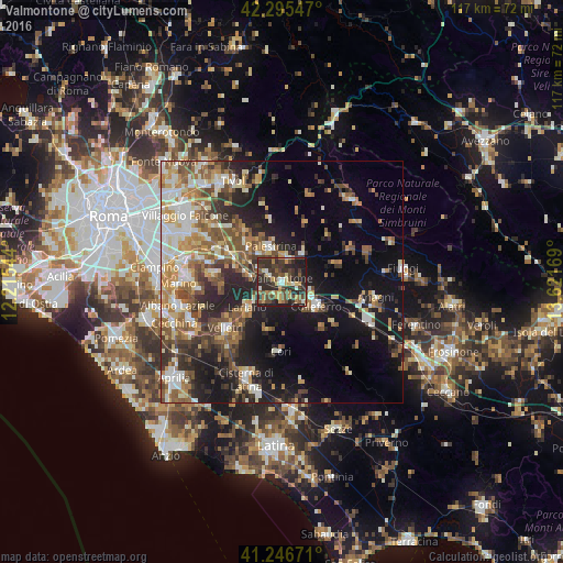
Analysis of Valmontone night lights 2016
Square area 10x10 km:
 2.76%
2.76%90-99
4.55%80-89
6.33%70-79
6.98%60-69
6.33%50-59
6.82%40-49
15.91%30-39
16.72%20-29
24.84%10-19
8.77%0-9
0%Square area 50x50 km:
3.86%90-99
5.85%80-89
4.06%70-79
4.39%60-69
4.79%50-59
5.91%40-49
5.55%30-39
5.04%20-29
8.82%10-19
16.13%0-9
35.6%Clear (daylight) street map image can be seen on geolist.org.
Map coordinates:
42° 17' 43.7" North, 12° 12' 55.6" East
41° 46' 23.6" North, 12° 55' 6.8" East
41° 14' 48.2" North, 13° 37' 18.1" East
Some cities around Valmontone sort by population:
• Colleferro
8.8 km =5.5 mi,  125°
125°
• Palestrina
7.3 km =4.5 mi,  335°
335°
• Lariano
9.6 km =6 mi,  230°
230°
• Zagarolo
11.4 km =7.1 mi,  311°
311°
• Artena
3.7 km =2.3 mi,  195°
195°
• San Cesareo
10.9 km =6.8 mi,  299°
299°
• Cave
5.2 km =3.2 mi,  20°
20°
• Segni
12.6 km =7.8 mi,  138°
138°
3164778 (p: 13,001)
Sources (retrieved 2019-11-25):
» Earth at Night: Flat Maps 2012, 2016