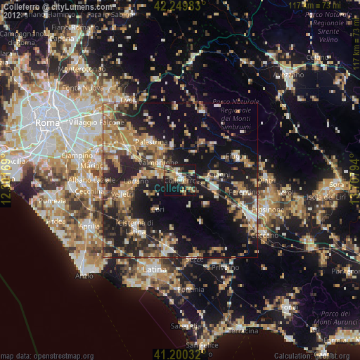
Colleferro night lights from space
Night Light of Colleferro (Latium) from space (Italy) Src. Average luminocity for 10x10km area is 32.4351% and for 50x50km: 25.6182%.
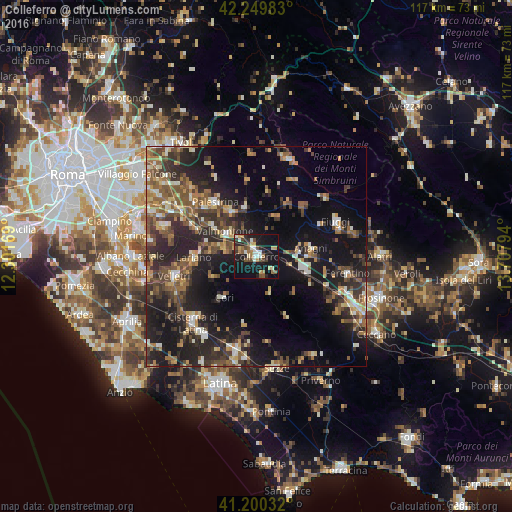
Analysis of Colleferro night lights 2016
Square area 10x10 km:
100  3.9%
3.9%
90-99 4.71%
80-89 4.38%
70-79 3.08%
60-69 4.87%
50-59 4.22%
40-49 5.84%
30-39 4.87%
20-29 6.82%
10-19 42.69%
0-9 14.61%
3.9%90-99
4.71%80-89
4.38%70-79
3.08%60-69
4.87%50-59
4.22%40-49
5.84%30-39
4.87%20-29
6.82%10-19
42.69%0-9
14.61%Square area 50x50 km:
100 1.35%
90-99 3.47%
80-89 2.73%
70-79 2.93%
60-69 3.98%
50-59 5.19%
40-49 5.3%
30-39 5.48%
20-29 10.42%
10-19 20.45%
0-9 38.68%
1.35%90-99
3.47%80-89
2.73%70-79
2.93%60-69
3.98%50-59
5.19%40-49
5.3%30-39
5.48%20-29
10.42%10-19
20.45%0-9
38.68%Clear (daylight) street map image can be seen on geolist.org.
Map coordinates:
42° 14' 59.4" North, 12° 18' 6.1" East
41° 43' 38" North, 13° 0' 17.3" East
41° 12' 1.2" North, 13° 42' 28.6" East
Some cities around Colleferro sort by population:
• Valmontone
8.8 km =5.5 mi,  305°
305°
• Lariano
14.6 km =9.1 mi,  266°
266°
• Artena
8.3 km =5.2 mi,  280°
280°
• Anagni
12.6 km =7.8 mi,  81°
81°
• Cave
11.3 km =7 mi,  331°
331°
• Segni
4.4 km =2.7 mi,  164°
164°
• Cori
12.1 km =7.5 mi,  219°
219°
• Paliano
8.3 km =5.2 mi,  45°
45°
3178398 (p: 20,736)
Sources (retrieved 2019-11-25):
» Earth at Night: Flat Maps 2012, 2016