San Cesareo night lights from space
Night Light of San Cesareo (Latium) from space (Italy) Src. Average luminocity for 10x10km area is 57.2545% and for 50x50km: 43.56%.
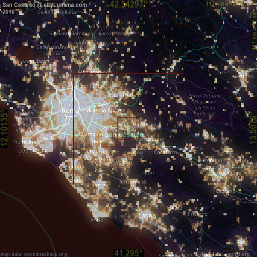
Analysis of San Cesareo night lights 2016
Square area 10x10 km:
 2.42%
2.42%90-99
8.79%80-89
6.82%70-79
7.73%60-69
12.12%50-59
26.36%40-49
15.3%30-39
9.7%20-29
10.76%10-19
0%0-9
0%Square area 50x50 km:
8.84%90-99
8.74%80-89
4.9%70-79
5.62%60-69
5.71%50-59
7.05%40-49
7.12%30-39
6.84%20-29
9.44%10-19
10.78%0-9
24.96%Clear (daylight) street map image can be seen on geolist.org.
Map coordinates:
42° 20' 34.7" North, 12° 6' 4.9" East
41° 49' 16.1" North, 12° 48' 16.1" East
41° 17' 42" North, 13° 30' 27.4" East
Some cities around San Cesareo sort by population:
• Frascati
10.4 km =6.5 mi,  262°
262°
• Rocca di Papa
10.5 km =6.5 mi,  234°
234°
• Palestrina
6.5 km =4 mi,  78°
78°
• Zagarolo
2.4 km =1.5 mi,  21°
21°
• Rocca Priora
6.9 km =4.3 mi,  207°
207°
• Monte Porzio Catone
7.5 km =4.7 mi,  265°
265°
• Montecompatri
5.7 km =3.5 mi, 256°
• Corcolle
10.8 km =6.7 mi,  328°
328°
3168485 (p: 10,529)
Sources (retrieved 2019-11-25):
» Earth at Night: Flat Maps 2012, 2016