Segni night lights from space
Night Light of Segni (Latium) from space (Italy) Src. Average luminocity for 10x10km area is 19.4627% and for 50x50km: 25.8619%.
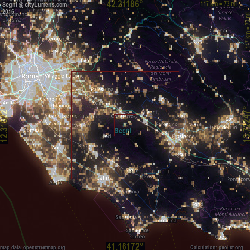
Analysis of Segni night lights 2016
Square area 10x10 km:
100  1.95%
1.95%
90-99 2.27%
80-89 2.92%
70-79 1.14%
60-69 3.08%
50-59 3.57%
40-49 2.6%
30-39 1.3%
20-29 2.11%
10-19 27.44%
0-9 51.62%
1.95%90-99
2.27%80-89
2.92%70-79
1.14%60-69
3.08%50-59
3.57%40-49
2.6%30-39
1.3%20-29
2.11%10-19
27.44%0-9
51.62%Square area 50x50 km:
100 1.49%
90-99 3.43%
80-89 2.83%
70-79 2.69%
60-69 3.88%
50-59 5.3%
40-49 5.32%
30-39 5.34%
20-29 10.98%
10-19 21.77%
0-9 36.95%
1.49%90-99
3.43%80-89
2.83%70-79
2.69%60-69
3.88%50-59
5.3%40-49
5.32%30-39
5.34%20-29
10.98%10-19
21.77%0-9
36.95%Clear (daylight) street map image can be seen on geolist.org.
Map coordinates:
42° 12' 42.7" North, 12° 18' 58.4" East
41° 41' 20.1" North, 13° 1' 9.6" East
41° 9' 42.2" North, 13° 43' 20.9" East
Some cities around Segni sort by population:
• Colleferro
4.4 km =2.7 mi,  344°
344°
• Valmontone
12.6 km =7.8 mi,  318°
318°
• Lariano
16.2 km =10.1 mi,  281°
281°
• Artena
11 km =6.8 mi,  301°
301°
• Anagni
12.8 km =8 mi,  61°
61°
• Cave
15.7 km =9.8 mi, 335°
• Cori
10.3 km =6.4 mi,  240°
240°
• Paliano
11.2 km =7 mi,  25°
25°
3166813 (p: 6,713)
Sources (retrieved 2019-11-25):
» Earth at Night: Flat Maps 2012, 2016