Cave night lights from space
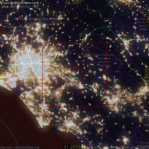
Night Light of Cave (Latium) from space (Italy) Src. Average luminocity for 10x10km area is 37.0318% and for 50x50km: 30.2655%.
Analysis of Cave night lights 2016
Square area 10x10 km:
 4.09%
4.09%90-99
4.85%80-89
5.45%70-79
4.7%60-69
1.97%50-59
4.24%40-49
9.7%30-39
11.36%20-29
15.61%10-19
26.82%0-9
11.21%Square area 50x50 km:
3.16%90-99
5.24%80-89
3.75%70-79
4.03%60-69
4.59%50-59
5.76%40-49
5.52%30-39
4.94%20-29
8.61%10-19
15.18%0-9
39.22%Clear (daylight) street map image can be seen on geolist.org.
Map coordinates:
42° 20' 19.3" North, 12° 14' 14.7" East
41° 49' 0.6" North, 12° 56' 26" East
41° 17' 26.3" North, 13° 38' 37.2" East
Some cities around Cave sort by population:
• Colleferro
11.3 km =7 mi,  151°
151°
• Palestrina
5.2 km =3.2 mi,  289°
289°
• Valmontone
5.2 km =3.2 mi,  200°
200°
• Zagarolo
10.7 km =6.6 mi,  284°
284°
• Artena
8.9 km =5.5 mi, 198°
• San Cesareo
11.3 km =7 mi,  272°
272°
• Paliano
12 km =7.5 mi,  110°
110°
• Olevano Romano
9.2 km =5.7 mi,  59°
59°
3179288 (p: 8,210)
Sources (retrieved 2019-11-25):
» Earth at Night: Flat Maps 2012, 2016