Pergine Valsugana night lights from space
Night Light of Pergine Valsugana (Trentino-Alto Adige) from space (Italy) Src. Average luminocity for 10x10km area is 21.8139% and for 50x50km: 10.1871%.
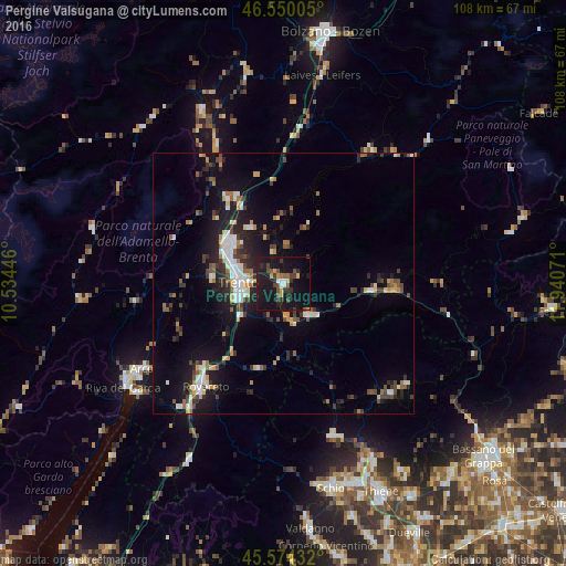
Analysis of Pergine Valsugana night lights 2016
Square area 10x10 km:
 1.7%
1.7%90-99
1.14%80-89
1.42%70-79
2.84%60-69
0.71%50-59
2.84%40-49
5.54%30-39
5.11%20-29
5.97%10-19
49.86%0-9
22.87%Square area 50x50 km:
1.22%90-99
1.62%80-89
0.72%70-79
1%60-69
1.15%50-59
1.24%40-49
1.6%30-39
1.72%20-29
3.18%10-19
8.98%0-9
77.58%Clear (daylight) street map image can be seen on geolist.org.
Map coordinates:
46° 33' 0.2" North, 10° 32' 4.1" East
46° 3' 51.6" North, 11° 14' 15.3" East
45° 34' 27.6" North, 11° 56' 26.6" East
Some cities around Pergine Valsugana sort by population:
• Trento
9 km =5.6 mi,  272°
272°
• Rovereto
24.6 km =15.3 mi,  218°
218°
• Mori
30.9 km =19.2 mi, 220°
• Mezzolombardo
19.3 km =12 mi,  325°
325°
• Borgo Valsugana
17 km =10.6 mi,  94°
94°
• Lavis
13.1 km =8.1 mi,  310°
310°
• Levico Terme
7.8 km =4.8 mi,  138°
138°
• Mattarello
10.4 km =6.5 mi,  233°
233°
3171214 (p: 11,538)
Sources (retrieved 2019-11-25):
» Earth at Night: Flat Maps 2012, 2016