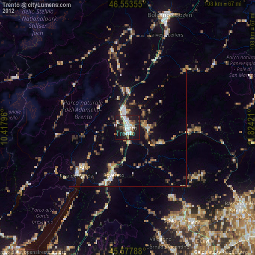
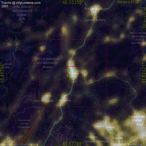
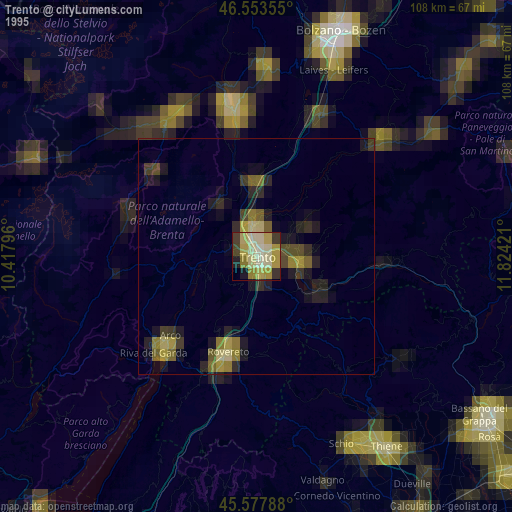
Trento night lights from space
Night Light of Trento (Trentino-Alto Adige) from space (Italy) Src. Average luminocity for 10x10km area is 46.9815% and for 50x50km: 10.4991%.

Analysis of Trento night lights 2016
Square area 10x10 km:
 11.65%
90-99
12.36%80-89
2.27%70-79
3.13%60-69
4.97%50-59
4.12%40-49
4.26%30-39
7.24%20-29
24.15%10-19
22.3%0-9
3.55%Square area 50x50 km:
1.37%90-99
1.79%80-89
0.75%70-79
1.02%60-69
1.1%50-59
1.29%40-49
1.36%30-39
1.58%20-29
3.19%10-19
10.35%0-9
76.2%Clear (daylight) street map image can be seen on geolist.org.
Map coordinates:
46° 33' 12.8" North, 10° 25' 4.7" East
46° 4' 4.3" North, 11° 7' 15.9" East
45° 34' 40.4" North, 11° 49' 27.2" East
Some cities around Trento sort by population:
• Rovereto
20.7 km =12.9 mi,  197°
197°
• Arco
24.6 km =15.3 mi,  227°
227°
• Pergine Valsugana
9 km =5.6 mi,  92°
92°
• Mezzolombardo
15.7 km =9.8 mi,  353°
353°
• Borgo Valsugana
26 km =16.2 mi, 94°
• Lavis
8.2 km =5.1 mi, 353°
• Levico Terme
15.4 km =9.6 mi,  113°
113°
• Mattarello
6.6 km =4.1 mi,  174°
174°
3165243 (p: 80,425)
Sources (retrieved 2019-11-25):
» NASA, Earths city lights 1995
» NASA city lights 2003
» Earth at Night: Flat Maps 2012, 2016