Leno night lights from space
Night Light of Leno (Lombardy) from space (Italy) Src. Average luminocity for 10x10km area is 28.0095% and for 50x50km: 39.2173%.
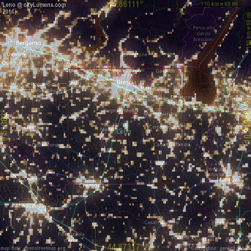
Analysis of Leno night lights 2016
Square area 10x10 km:
 4.13%
4.13%90-99
4.13%80-89
2.06%70-79
2.06%60-69
0.95%50-59
2.22%40-49
0.48%30-39
5.87%20-29
15.08%10-19
57.46%0-9
5.56%Square area 50x50 km:
6.61%90-99
7.87%80-89
3.47%70-79
3.6%60-69
5%50-59
5.61%40-49
6.26%30-39
7.99%20-29
11.82%10-19
27.4%0-9
14.36%Clear (daylight) street map image can be seen on geolist.org.
Map coordinates:
45° 51' 40" North, 9° 30' 49.1" East
45° 22' 9.5" North, 10° 13' 0.3" East
44° 52' 23.4" North, 10° 55' 11.6" East
Some cities around Leno sort by population:
• Ghedi
5.9 km =3.7 mi,  52°
52°
• Manerbio
6.4 km =4 mi,  254°
254°
• Bagnolo Mella
6.9 km =4.3 mi,  339°
339°
• Borgosatollo
12.1 km =7.5 mi,  8°
8°
• Castenedolo
13 km =8.1 mi,  26°
26°
• Flero
13 km =8.1 mi,  346°
346°
• Verolanuova
11.7 km =7.3 mi, 247°
• Pontevico
14.4 km =8.9 mi,  222°
222°
3174892 (p: 10,172)
Sources (retrieved 2019-11-25):
» Earth at Night: Flat Maps 2012, 2016