Cerea night lights from space
Night Light of Cerea (Veneto) from space (Italy) Src. Average luminocity for 10x10km area is 46.1364% and for 50x50km: 27.9162%.
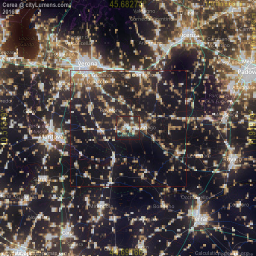
Analysis of Cerea night lights 2016
Square area 10x10 km:
 6.36%
6.36%90-99
8.18%80-89
5.76%70-79
3.03%60-69
6.52%50-59
6.06%40-49
10.91%30-39
10.3%20-29
25.76%10-19
17.12%0-9
0%Square area 50x50 km:
2.77%90-99
4.09%80-89
2.72%70-79
2.78%60-69
3.46%50-59
4.25%40-49
4.99%30-39
4.71%20-29
11.54%10-19
30.49%0-9
28.2%Clear (daylight) street map image can be seen on geolist.org.
Map coordinates:
45° 40' 57.9" North, 10° 30' 48.6" East
45° 11' 21.7" North, 11° 12' 59.8" East
44° 41' 30" North, 11° 55' 11.1" East
Some cities around Cerea sort by population:
• Legnago
6.7 km =4.2 mi,  85°
85°
• San Bonifacio
23.4 km =14.5 mi,  10°
10°
• Bovolone
11.1 km =6.9 mi,  316°
316°
• Zevio
21.4 km =13.3 mi,  341°
341°
• Isola della Scala
18.6 km =11.6 mi,  298°
298°
• Montagnana
20 km =12.4 mi,  76°
76°
• Nogara
12.3 km =7.6 mi,  265°
265°
• Ostiglia
14.8 km =9.2 mi,  205°
205°
3179106 (p: 12,869)
Sources (retrieved 2019-11-25):
» Earth at Night: Flat Maps 2012, 2016