Isola della Scala night lights from space
Night Light of Isola della Scala (Veneto) from space (Italy) Src. Average luminocity for 10x10km area is 31.1712% and for 50x50km: 39.1975%.
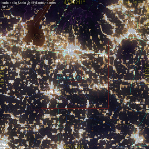
Analysis of Isola della Scala night lights 2016
Square area 10x10 km:
 1.67%
1.67%90-99
3.64%80-89
3.94%70-79
3.33%60-69
4.24%50-59
3.48%40-49
3.33%30-39
3.33%20-29
18.79%10-19
54.09%0-9
0.15%Square area 50x50 km:
5.98%90-99
7.63%80-89
3.58%70-79
3.82%60-69
5.24%50-59
5.71%40-49
5.8%30-39
6.41%20-29
17.83%10-19
26.02%0-9
11.97%Clear (daylight) street map image can be seen on geolist.org.
Map coordinates:
45° 45' 43.6" North, 10° 18' 18.4" East
45° 16' 9.9" North, 11° 0' 29.7" East
44° 46' 20.7" North, 11° 42' 40.9" East
Some cities around Isola della Scala sort by population:
• San Giovanni Lupatoto
12.8 km =8 mi,  12°
12°
• Bovolone
8.6 km =5.3 mi,  95°
95°
• Zevio
14.8 km =9.2 mi,  39°
39°
• Beccacivetta-Azzano
12.2 km =7.6 mi,  342°
342°
• Nogara
10.6 km =6.6 mi,  157°
157°
• Vigasio
7.4 km =4.6 mi,  316°
316°
• Povegliano Veronese
13.2 km =8.2 mi,  310°
310°
• Dossobuono
15.8 km =9.8 mi,  330°
330°
3175428 (p: 8,348)
Sources (retrieved 2019-11-25):
» Earth at Night: Flat Maps 2012, 2016