Taft night lights from space
Night Light of Taft (Yazd) from space (Iran) Src. Average luminocity for 10x10km area is 36.4945% and for 50x50km: 20.8705%.
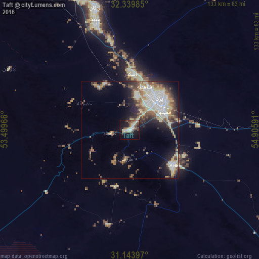
Analysis of Taft night lights 2016
Square area 10x10 km:
 3.3%
3.3%90-99
8.97%80-89
6.96%70-79
2.75%60-69
1.47%50-59
8.06%40-49
5.86%30-39
4.21%20-29
6.96%10-19
32.6%0-9
18.86%Square area 50x50 km:
3.53%90-99
3.94%80-89
4.01%70-79
2.13%60-69
1.78%50-59
3.37%40-49
3.18%30-39
2.65%20-29
4.23%10-19
8.45%0-9
62.74%Clear (daylight) street map image can be seen on geolist.org.
Map coordinates:
32° 20' 23.5" North, 53° 29' 58.8" East
31° 44' 37.8" North, 54° 12' 10" East
31° 8' 38.3" North, 54° 54' 21.3" East
Some cities around Taft sort by population:
• Yazd
23.1 km =14.4 mi,  42°
42°
• Ardakān
65.3 km =40.6 mi,  344°
344°
• Ābādeh
160.9 km =100 mi,  246°
246°
• Shahr-e Bābak
200.9 km =124.8 mi,  154°
154°
• Meybod
59 km =36.7 mi, 342°
• Mahrīz
28.8 km =17.9 mi,  127°
127°
• Bāfq
114.6 km =71.2 mi,  97°
97°
• Pāsārgād
197.2 km =122.5 mi,  209°
209°
113632 (p: 19,394)
Sources (retrieved 2019-11-25):
» Earth at Night: Flat Maps 2012, 2016