Mahrīz night lights from space
Night Light of Mahrīz (Yazd) from space (Iran) Src. Average luminocity for 10x10km area is 52.6154% and for 50x50km: 9.0243%.
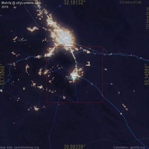
Analysis of Mahrīz night lights 2016
Square area 10x10 km:
 8.04%
8.04%90-99
8.92%80-89
18.88%70-79
4.72%60-69
1.75%50-59
3.32%40-49
8.92%30-39
6.64%20-29
15.91%10-19
21.68%0-9
1.22%Square area 50x50 km:
0.49%90-99
0.9%80-89
2.29%70-79
0.96%60-69
0.37%50-59
1.53%40-49
1.94%30-39
1.9%20-29
2.89%10-19
6.44%0-9
80.28%Clear (daylight) street map image can be seen on geolist.org.
Map coordinates:
32° 10' 52.8" North, 53° 44' 22.8" East
31° 35' 3.4" North, 54° 26' 34.1" East
30° 59' 0.2" North, 55° 8' 45.3" East
Some cities around Mahrīz sort by population:
• Yazd
35.5 km =22.1 mi,  348°
348°
• Ardakān
90.1 km =56 mi,  333°
333°
• Ābādeh
176.5 km =109.7 mi,  254°
254°
• Shahr-e Bābak
175.5 km =109.1 mi,  158°
158°
• Meybod
84.3 km =52.4 mi, 331°
• Bāfq
90.9 km =56.5 mi,  88°
88°
• Taft
28.8 km =17.9 mi,  307°
307°
• Shahrak-e Pābedānā
192.3 km =119.5 mi,  105°
105°
124274 (p: 36,720)
Sources (retrieved 2019-11-25):
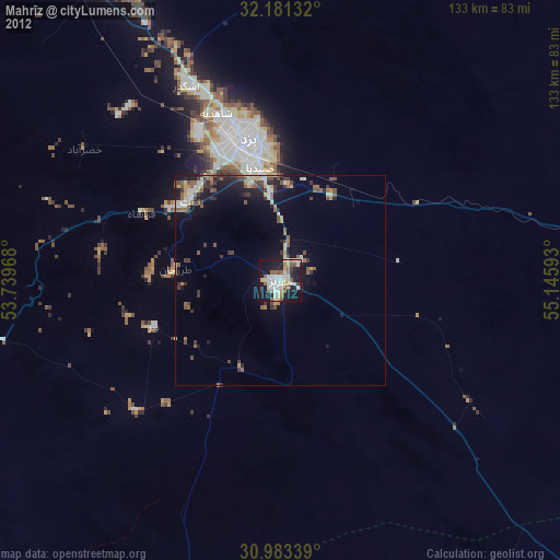
» Earth at Night: Flat Maps 2012, 2016